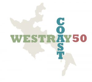
Westray Coast 50 – Day One
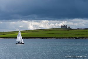
It was the day of the Westray Regatta, Saturday 29 July 2017, and, after a wonderful time watching the daredevil sailing and comedy races, we went to the Westray Heritage Centre to have a look at the shop. In it was a book called Westray Walkabout by Peter MacIntyre. I looked at the back cover and realised the book detailed Peter’s exploits in walking the entire coast of the island of Westray in a single day. I picked it up, opened it, and read the first line, “The next day was Saturday, 29th July, 1967 – Regatta Day for the Westray Sailing Club.”
“That’s exactly 50 years ago today”, I thought. 50 years. What an incredible coincidence. Why haven’t we, as an Island, done something to commemorate or celebrate Peter’s walk around the Island? I’d previously walked the five Orkney Islands Council walks around small areas of Westray but they were hampered by there being little or no parking at the starting / ending point and not including more of the spectacular coast. Despite thinking that all coincidences are inherently meaningless, I’m inspired by the coincidence. It’s fifty years to the day that Peter set off to walk the entire coast of Westray in a day.
What a great idea.
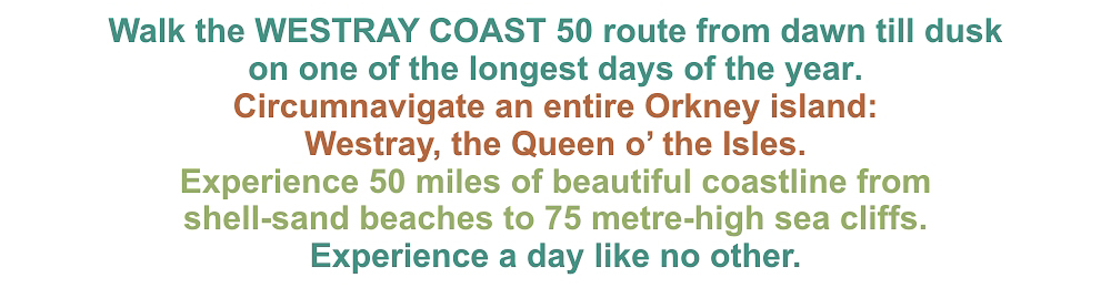
In a way which is typical of me, I don’t just think about walking the full coast on my own, I dream up a whole Island event, create a name for the route, design a logo, come up with a colour scheme, talk with friends and find people willing to sponsor the event. I even come up with the purpose of the event, which is to raise money to open up the route and make it safe for others to come and enjoy the spectacular experience of circumnavigating an entire island, in the future. I also imagine the concerns of the farmers whose entire livelihood depends upon their precious flocks and herds and their worries about keeping their animals safe. I imagine people in 50 years time coming and having the same experience of walking here.

Then, of course, for anyone who knows me, my idea gets bigger, as I dream up a week-long festival of walking with well-prepared groups of four people doing 10 miles a day from Monday to Friday with a full round-the-Island walk on the Saturday. I imagine an Orkney musician I admire greatly being commissioned to write an hour-long piece of music to celebrate the event. I imagine its international premier being held on the Island. I imagine the Westray Coast 50 becoming a tradition known throughout the islands and even further afield.
Then, of course, my idea gets bigger as I imagine an International Festival of the Coast being hosted by the Island, with artists, photographers, musicians, walkers, outdoors-lovers and fitness enthusiasts converging to celebrate a life led on the edge. I imagine the community joining in, the accommodation on the Island being full, people selling coffees and lunches and frozen yoghurt and… Yes, I’m a dreamer, I know. But I’m not the only one.
Here’s my marketing blurb:
First I have to find someone locally who has time to provide simple, local and practical help to start it off. I can’t find anyone. Everyone loves my idea and everyone’s too busy with their own lives. Why don’t I just do the walk on my own? That was my original idea, anyway. 50 miles in a day sounds too much for me. I’m over 50. 50 miles in 5 days sounds much better. I think I could do that.
I’m going to walk it on my own.
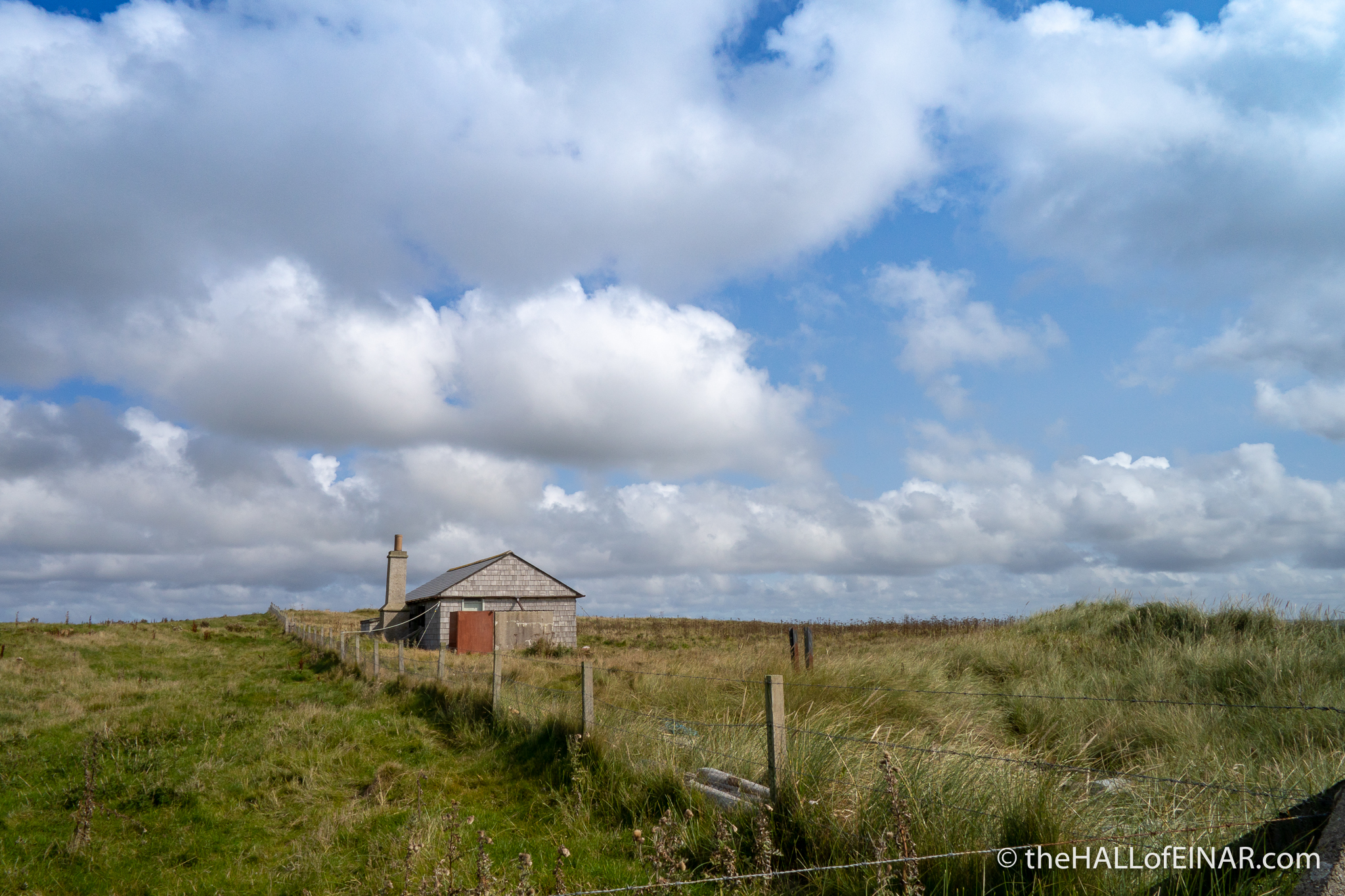
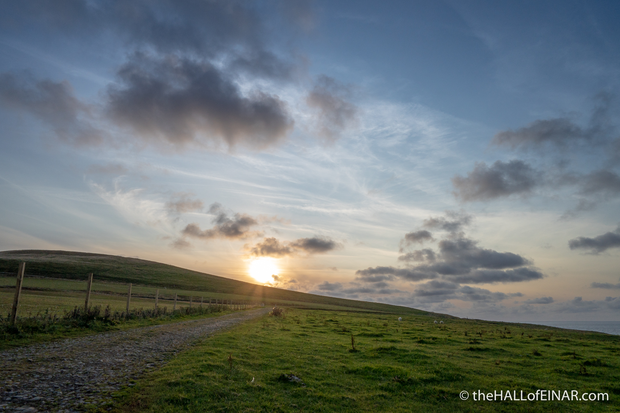
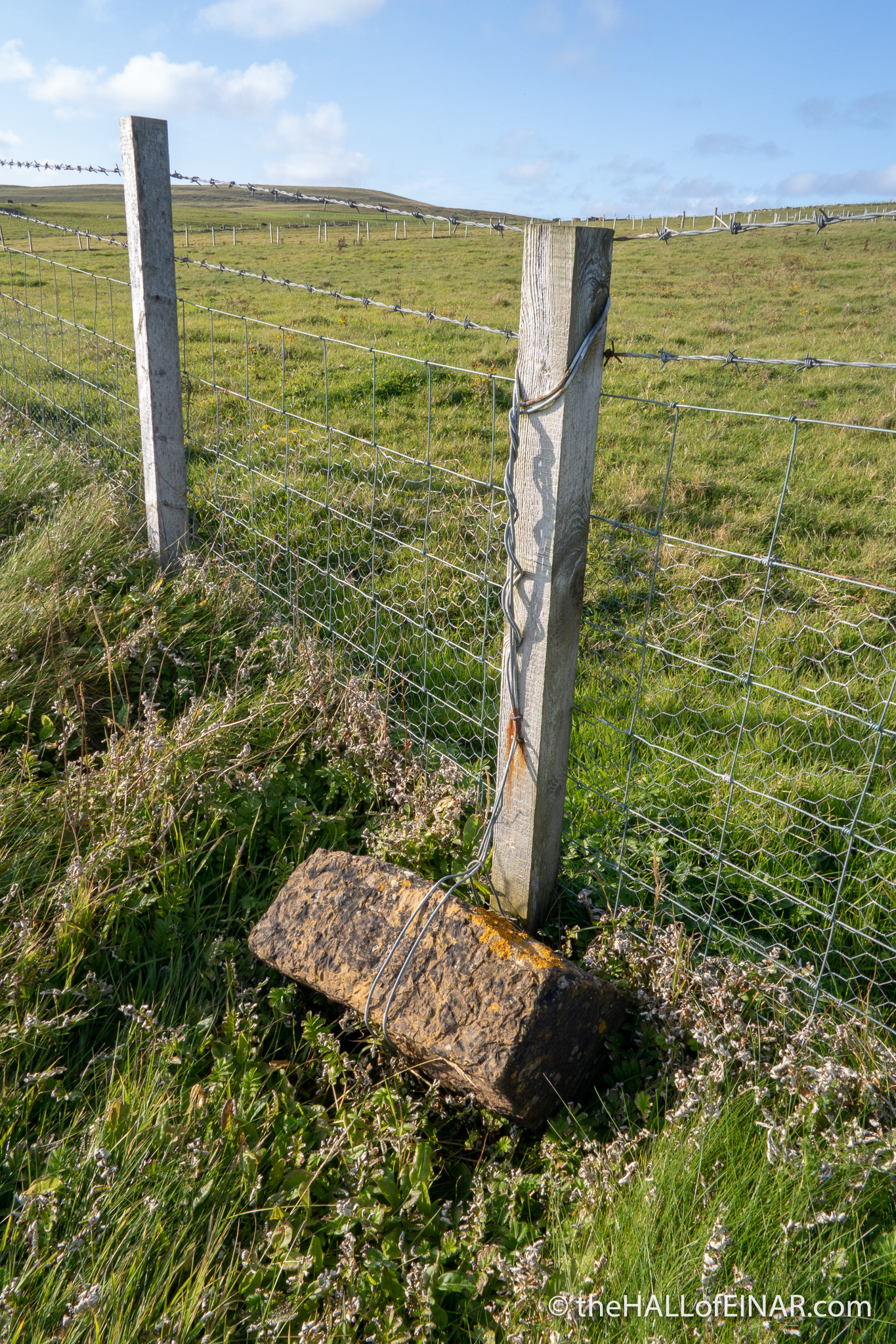
Here I am then, poised to start walking the entire circumference of an island today. Can I do it? Will my legs take it? Will my currently septic toe be okay? Will I ever stop asking questions? There’s only one way to find out. I’m going to walk the first day, Monday, from the Laird’s Hut on Mae Sands to Noup Farm. It’s 9.7 miles along some of the most spectacular cliffs Westray has to offer. I drive up past Noup Farm to North House and leave my bicycle, unlocked, leaning against a wall. It’s hard to steal anything on Westray because you can’t get off the island with it, and anyway, most things are probably owned by a member of your extended family, so why would you? I drive to Mae Sands and leave my car in one of the two parking spaces. The safest place to leave your keys is always in the ignition. Then you can’t lose them on the cliffs. Now I’ll be able to cycle back to my car after the walk, assuming I complete it. Either way, I’ve got to get back to my car or my bicycle before sunset.
Peter MacIntyre started his walk at 6:00am at the Laird’s Hut on Mae Sands. Despite my best intentions it’s 2:00pm before I start. I don’t feel bad; Peter didn’t have to spend hours deciding which camera gear to pack. He started with a bowl of porridge, bacon and eggs and scalding tea. I start with porridge and tea.

Peter wore a woollen jersey and walked the whole circuit in gymshoes. I’ve got a waterproof coat and walking boots with a huge camera with a telephoto lens around my neck.
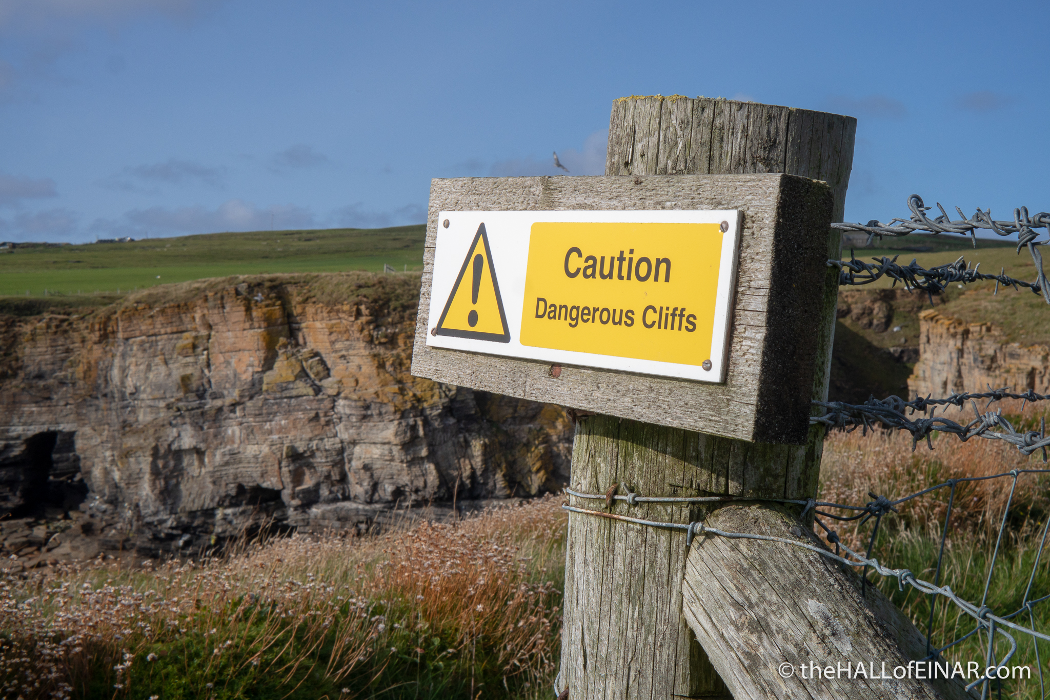
Just a note: Never do this walk on your own without taking extreme precautions. Much of the Island has no mobile phone signal, is extremely isolated and there are dangerous surfaces. Grass is slippery, rocks are slippery, gulleys, ravines and rock crevices and collapsed sea caves abound and if you do fall and break a leg, break a hip or bang your head, no-one will hear you scream. Ring the coastguard in Kirkwall and tell them where you’re walking, your route and the timing and let them know afterwards that you’re back safely. Text a friend or relative with your progress. “1/10”, “2/10” and so on, so they at least know where to look for your body other than seeing the flock of Ravens pecking your eyes out.
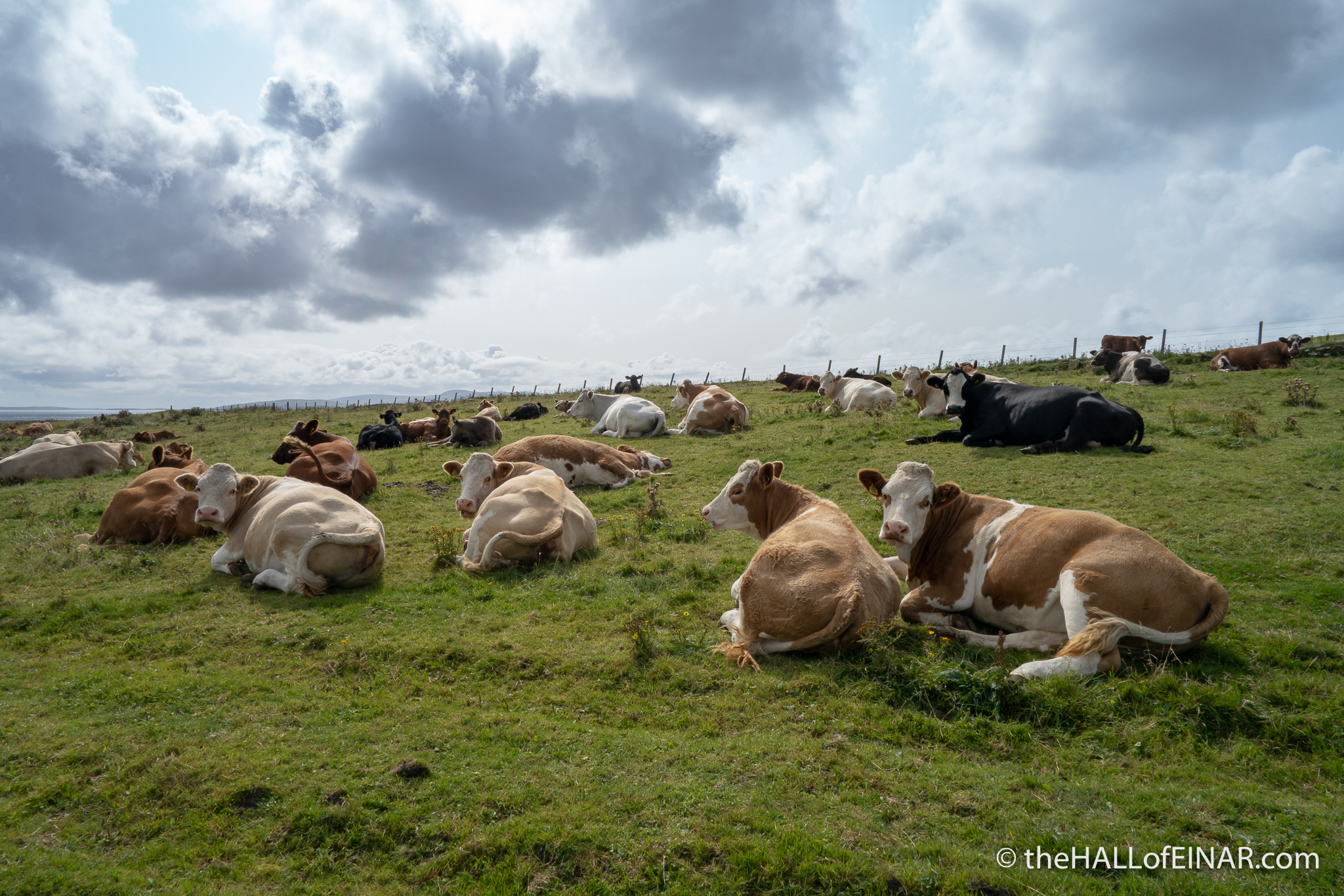
It’s a glorious day. The cattle are, rather curiously, all lying down in the field alongside the path. Usually, a group of beef steers would be charging along the fence, desperate to find out what I’m doing. It looks like these cows are taking it easy today though.
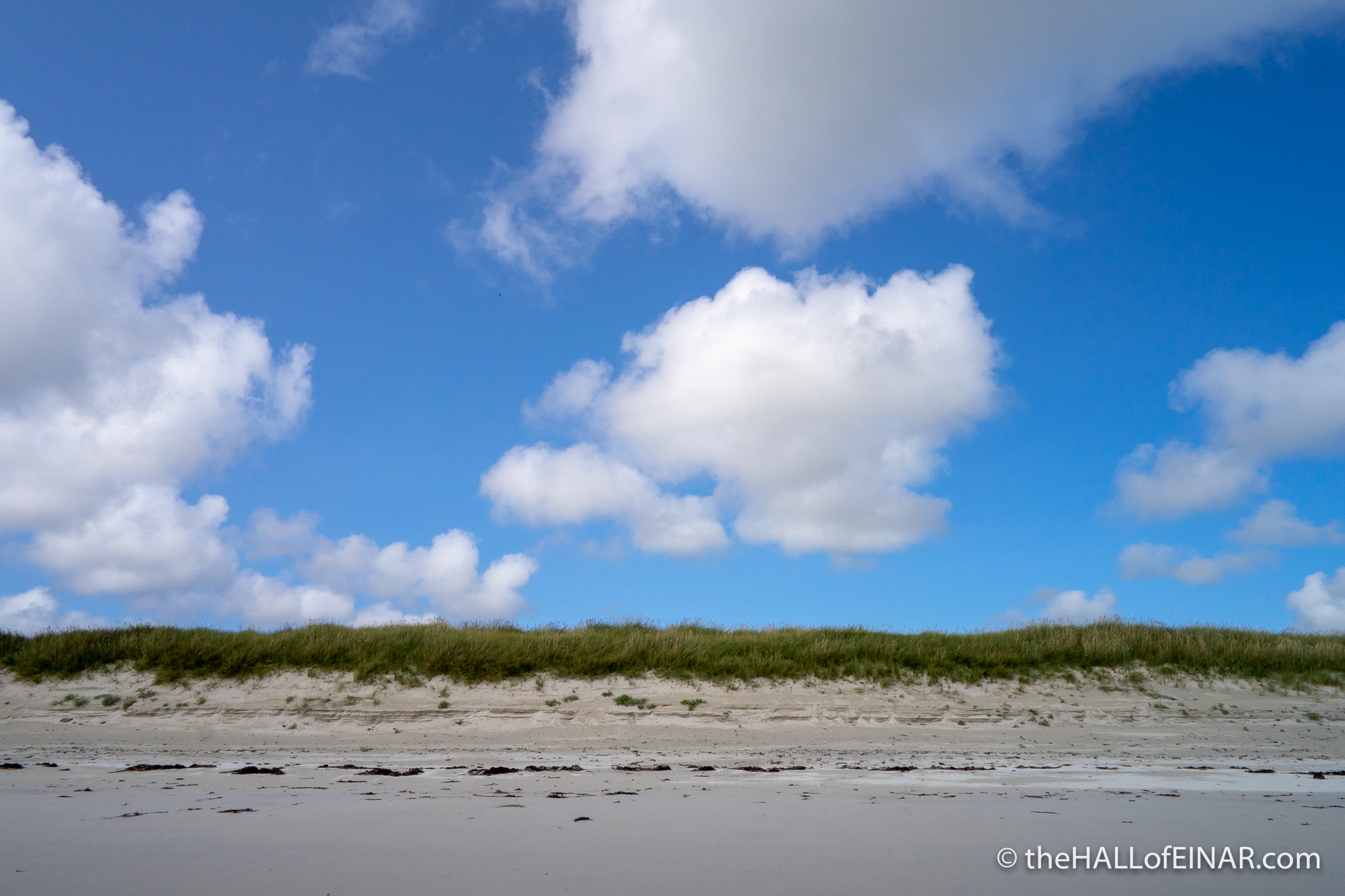
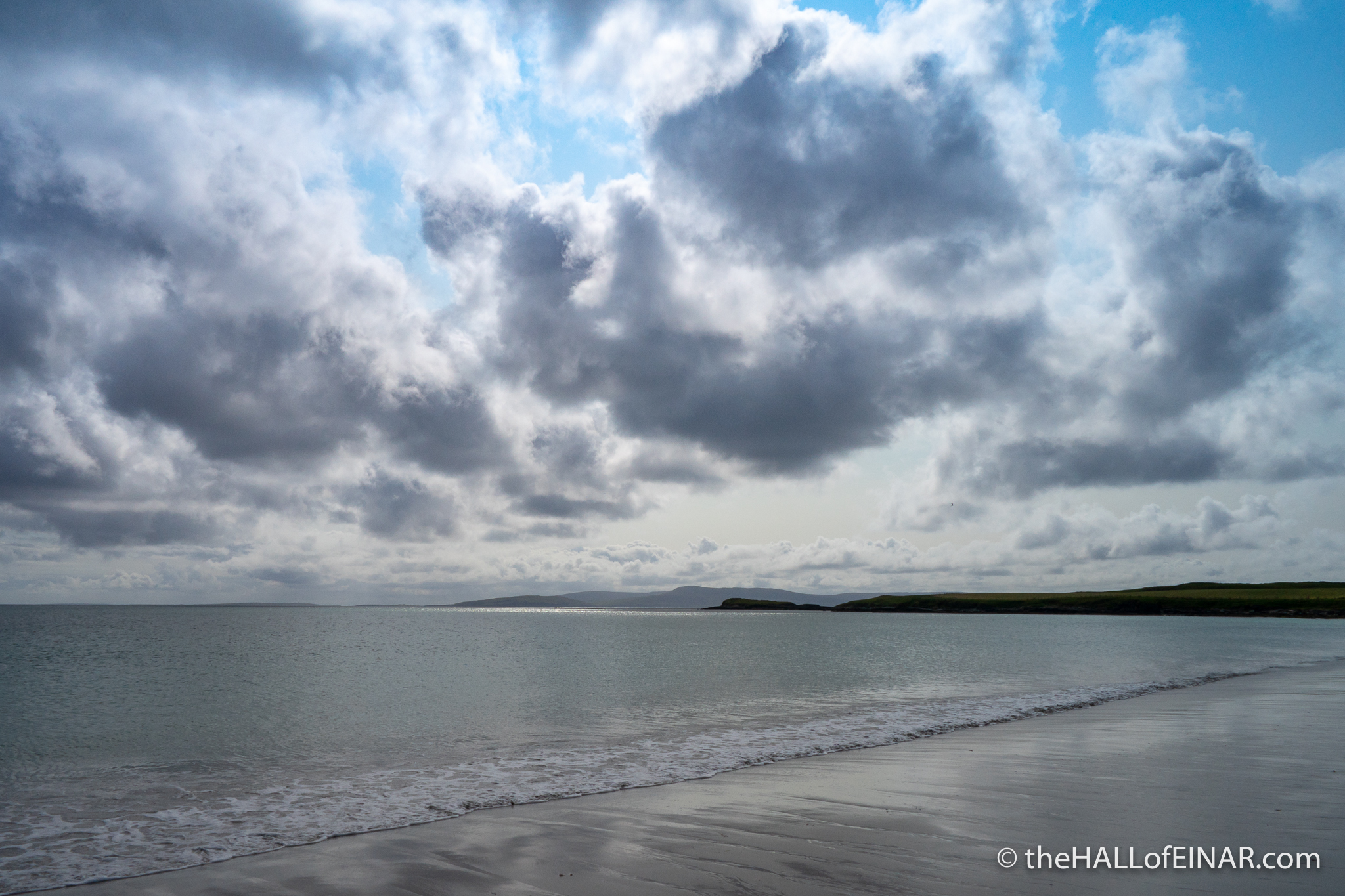
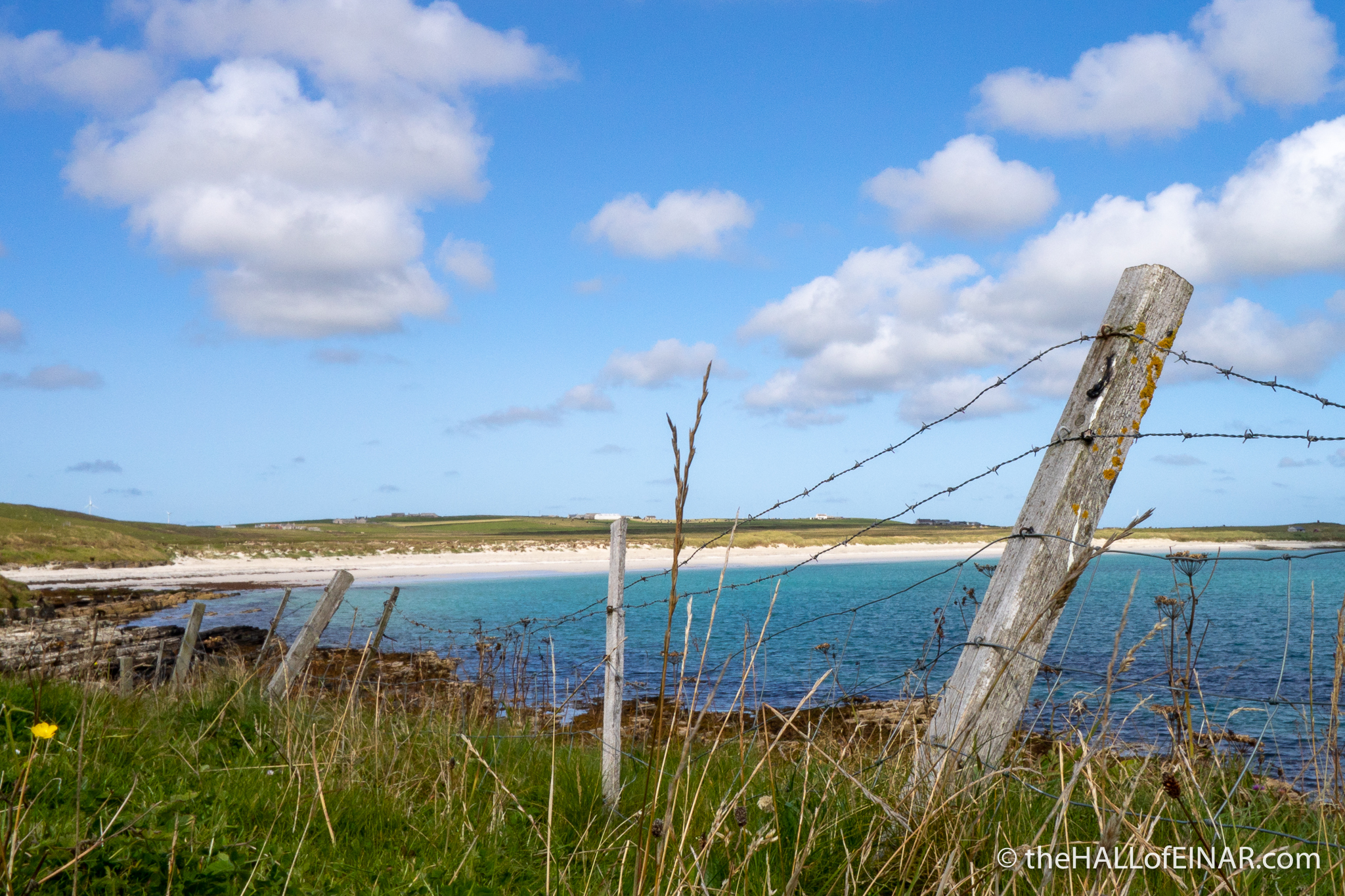
Mae Sands is a shell-sand beach and has glorious shallow water, teeming with small fish and hermit crabs.
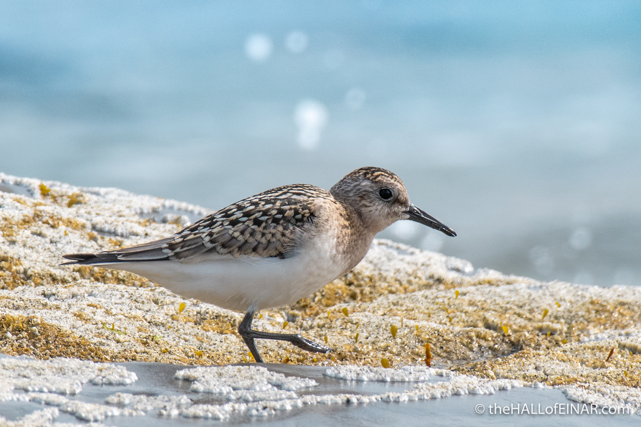
There are Sanderling skipping along the tideline and Great Black Backed Gulls calling ominously overhead, their massive wings producing large shadows on the sand.
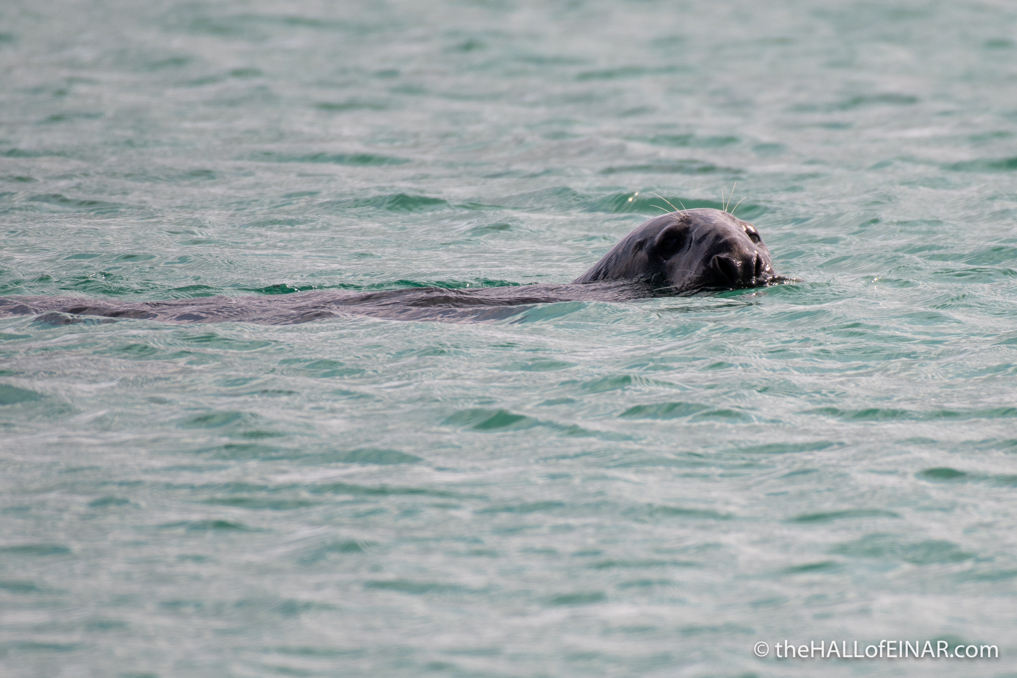
I’m meant to be walking but already I’m stopped by a Grey Seal swimming along the beach peering at me:
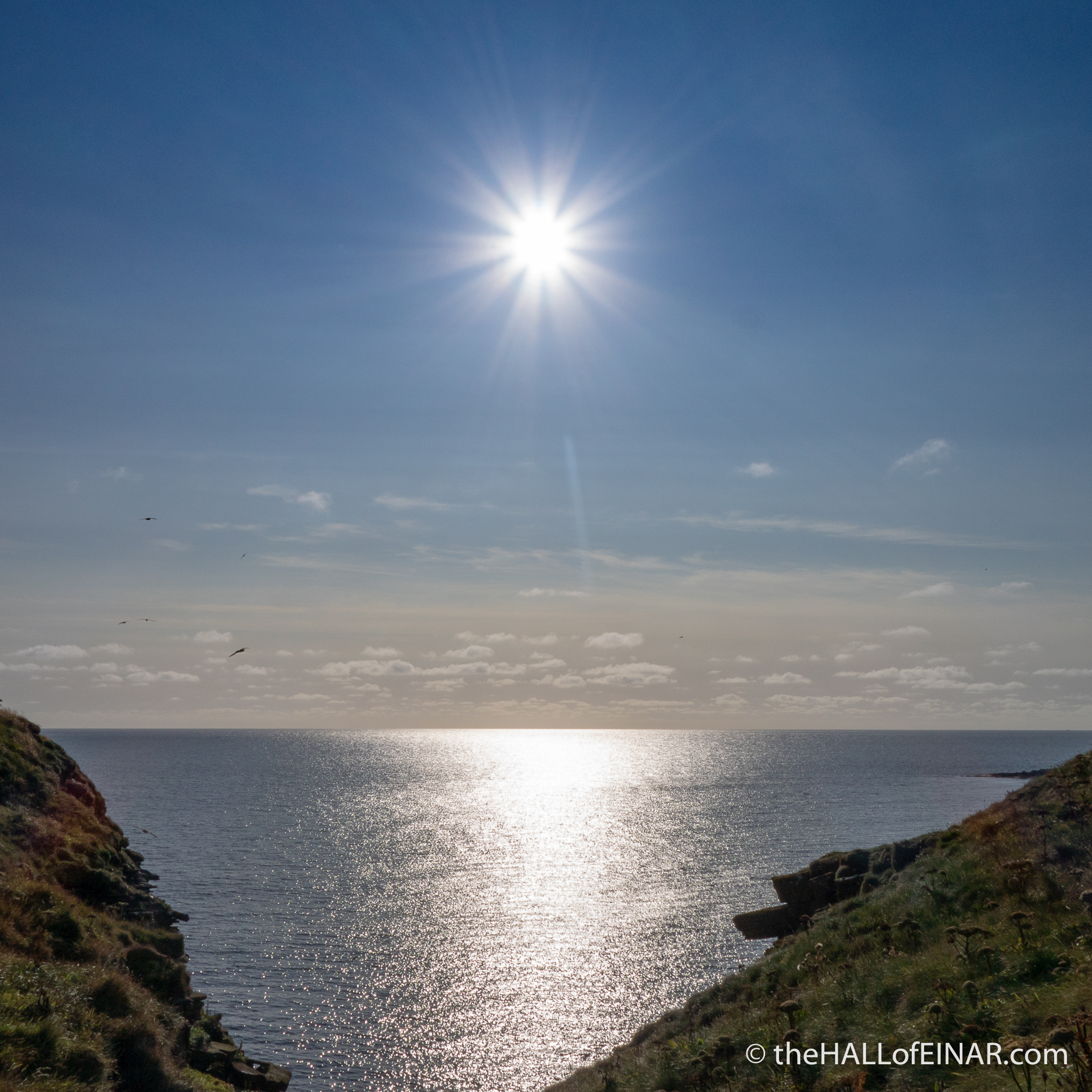
Looking out to sea I can see the island of Rousay, at least that’s what I always tell myself.

There are three islands, Rousay, Egilsay and Wyre, nearby and I haven’t been to any of them. Egilsay is to the left and Rousay is high is my thinking.
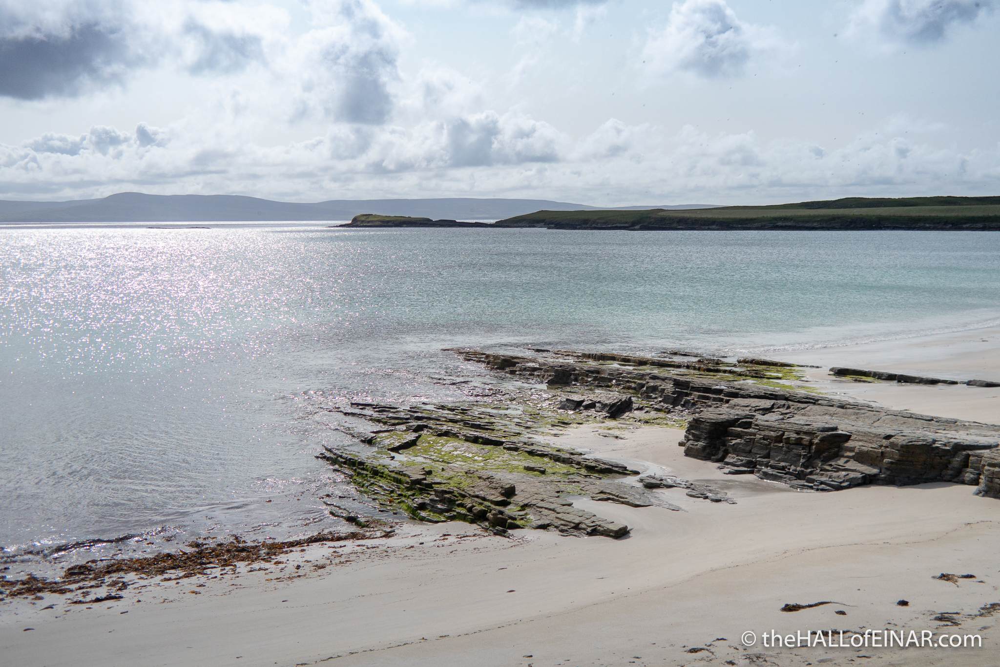
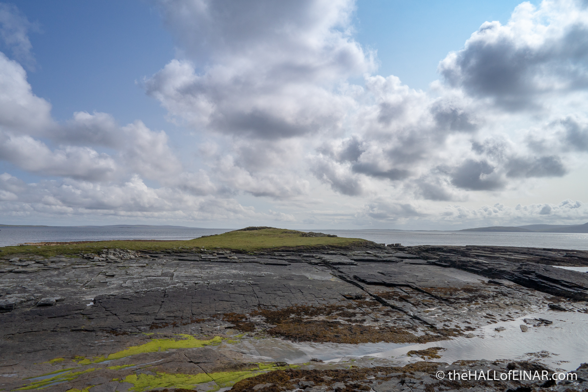
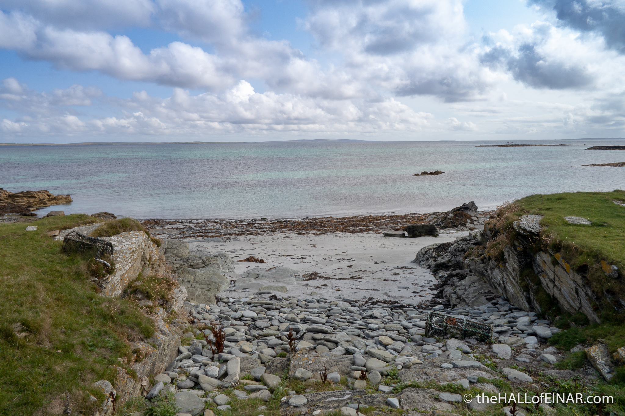
There’s also a fascinating headland in front of me, the Knowe o’ Skea, where the currents meet and the sea boils and an Iron Age burial ground gives fascinating insights into our ancestors:
It’s here I spent a mesmerising time with an Otter as it preened and squirmed in the brown seaweed a few years ago:
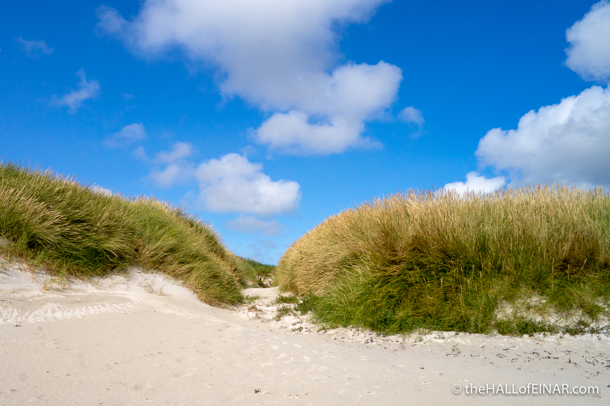
I head off, clockwise around the Island. “All I have to do is keep the sea on my left”, I said to a friend on the Island. “Yes, that’s what I said to a group of tourists and they still managed to get lost,” she tells me. I carry on. There’s a long way to go and it’s hard to look where you’re going when you’re surrounded by such beauty and so many interesting finds.
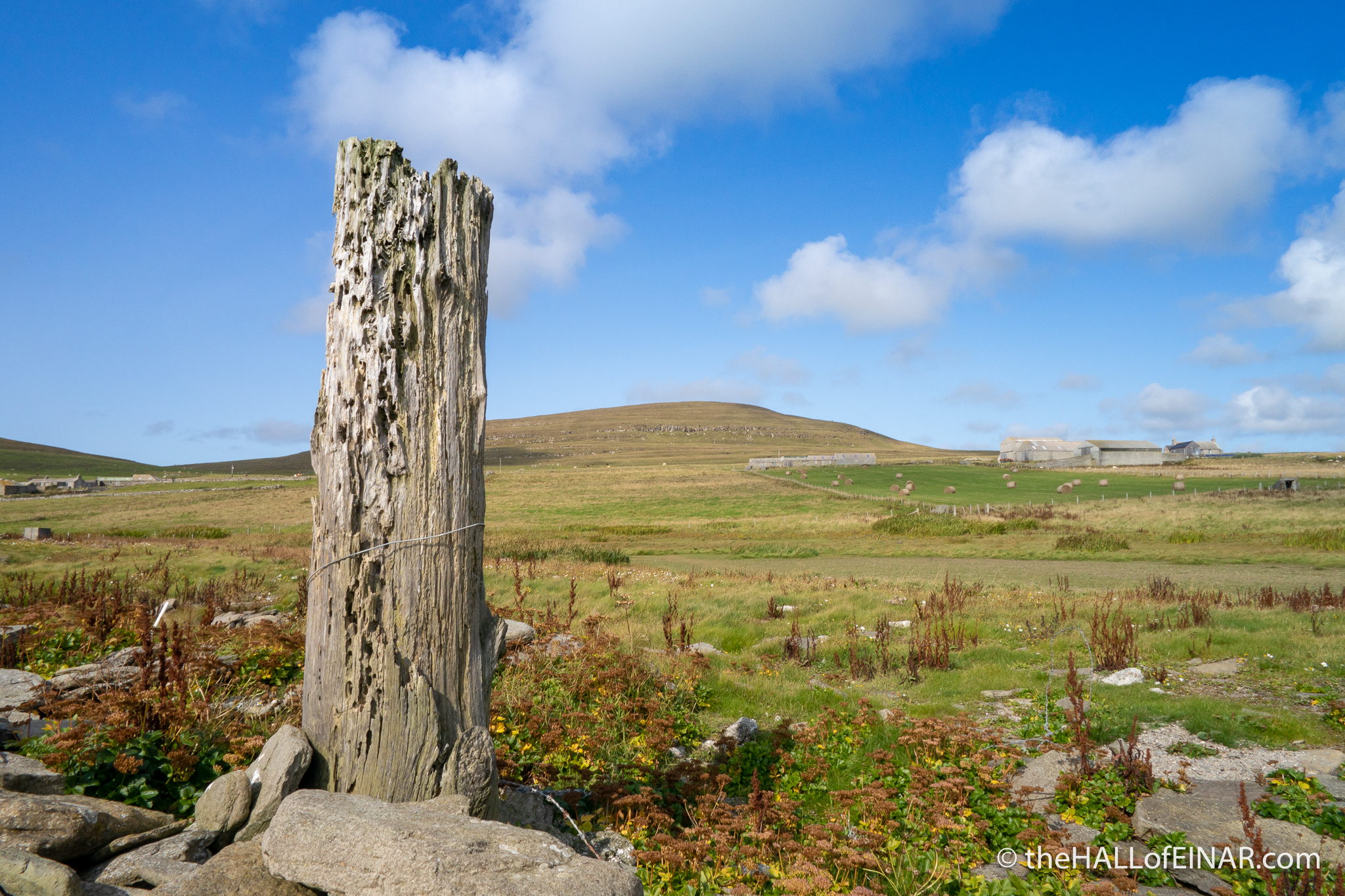
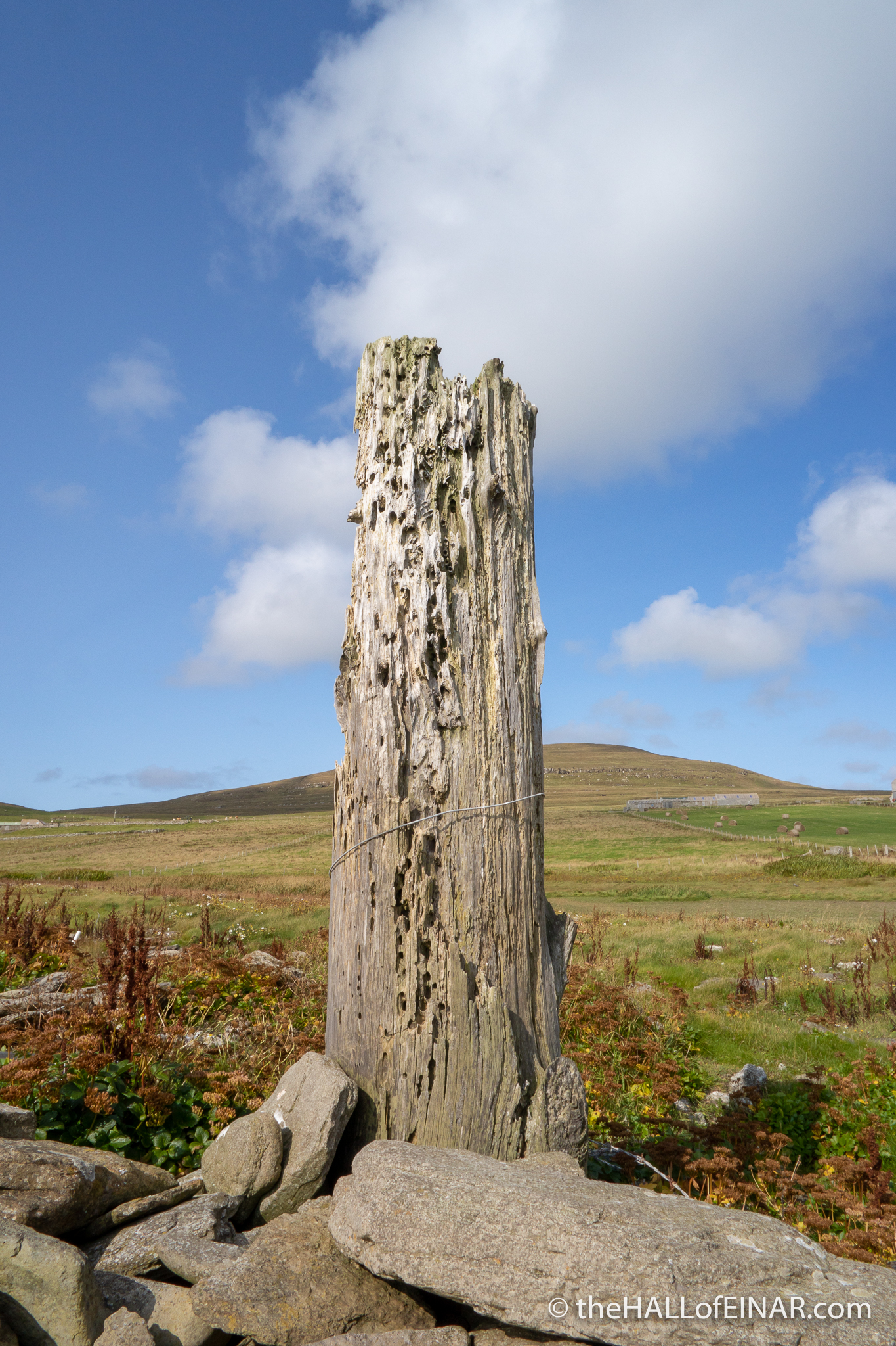
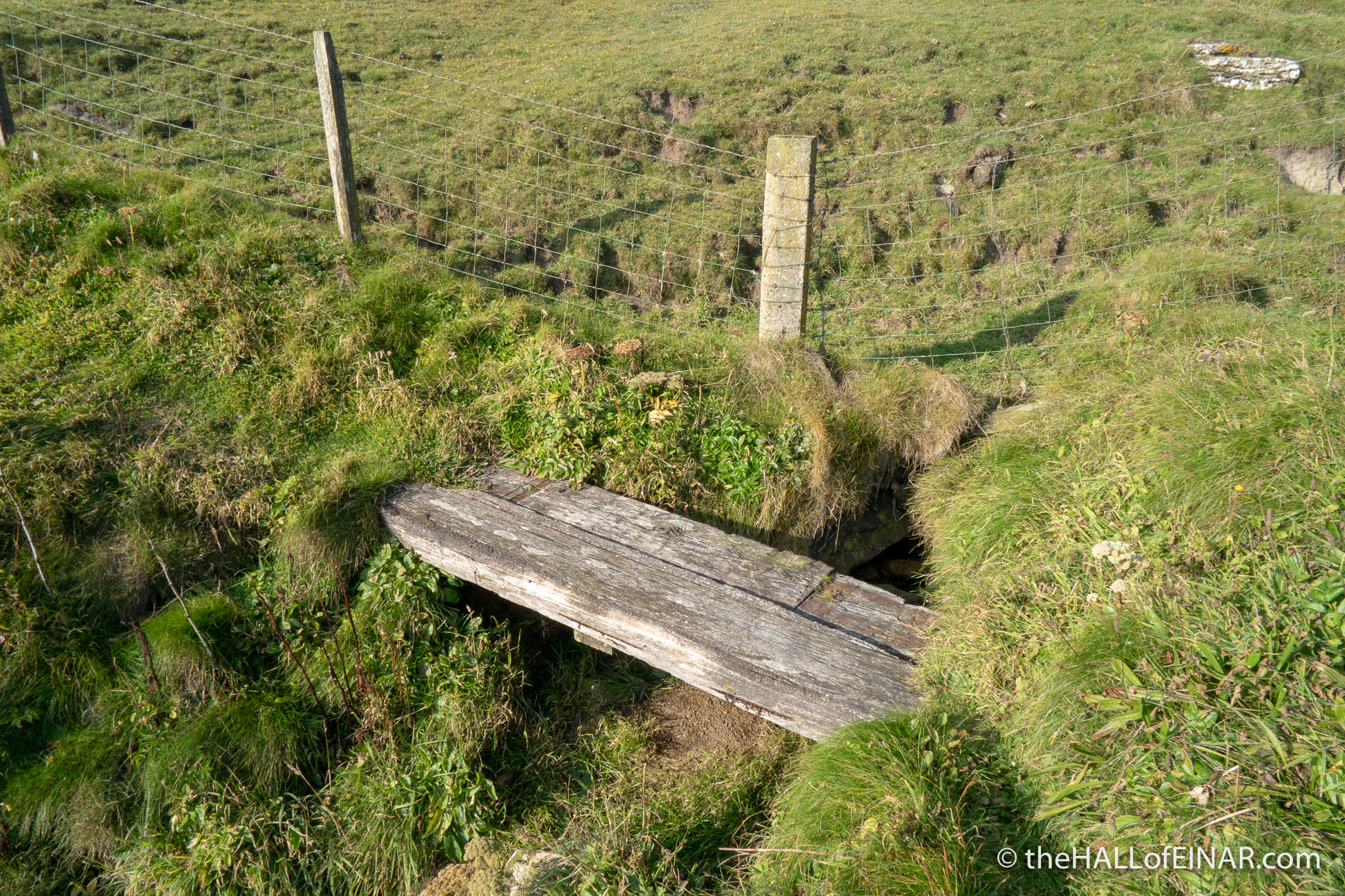
There’s a large lump of metal which looks like a winch and a tall post on the shore:
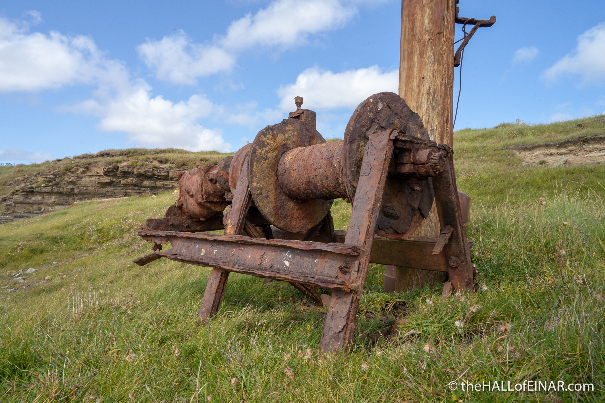
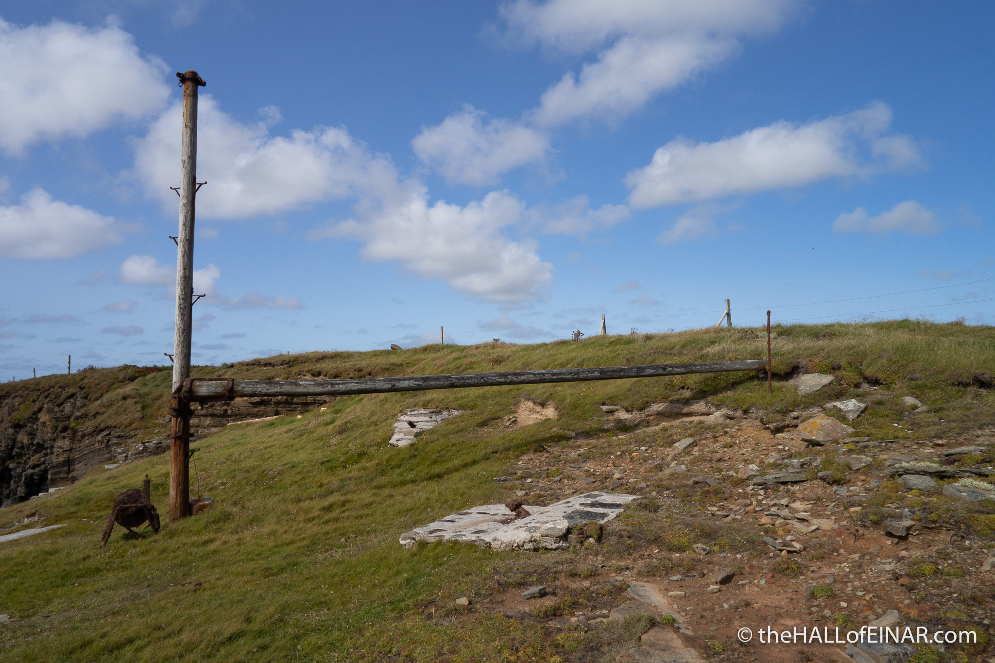
It’s for pulling ‘tangles’, or large bundles of kelp out of the ‘geo’ or rocks. There was a very successful seasonal industry of harvesting the huge kelp seaweed on the island which only stopped in 1997. It was powered by “A petrol engine oot o a car”. The place names along the coast are fascinating, quirky and very, very old. Many are Norse. I’m told there’s “Tangly Geo, Cleaving Geo, then Breed Geo which is where boats landed fish and weemen tuk bread down to them and carted fish up to langskail wi horse.” Signs of our relationship with the natural world and fascinating links with the past are everywhere here.
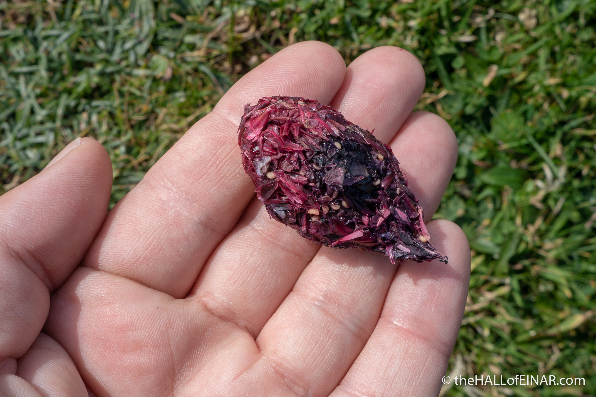
Perched on the rocks are several pellets coughed up by birds. This purple one caught my eye. It’s probably from a Raven which has been eating Crowberries:
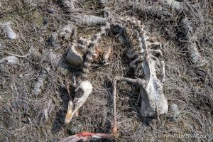
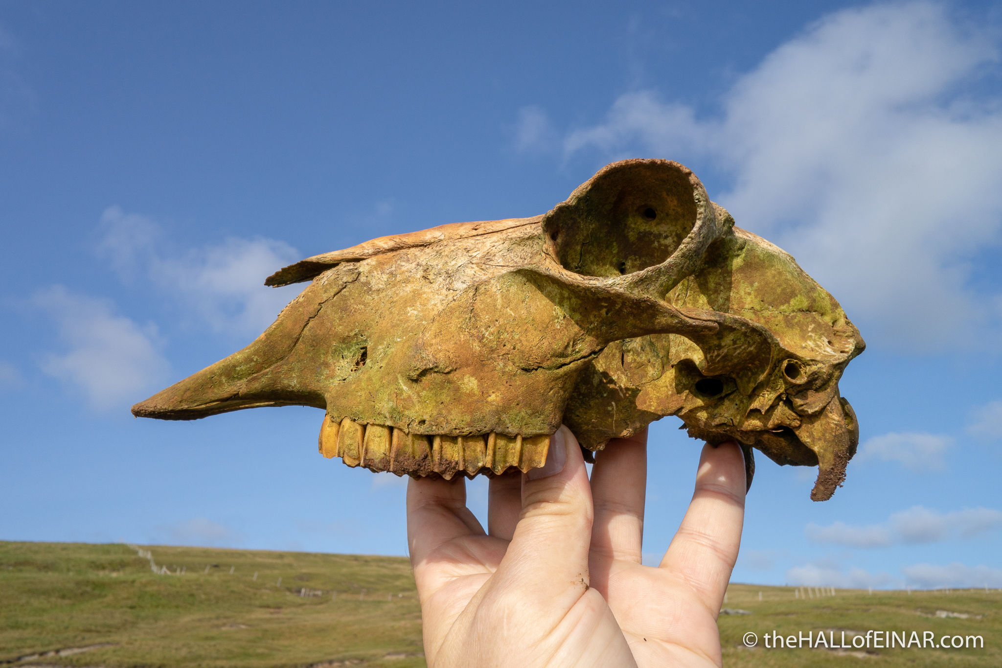
As I walk on I can see a flock of twenty or so Ravens around the shallow pool called Muckle Water. They fly away before I can see them properly or count them. Walking along Muckle Water I see the corpse of a Pink Footed Goose, which has recently been picked clean. If I’d only been here to photograph the Ravens doing that, what a sight it would have been.
The geology here means you could literally have a field day. Orkney was a huge inland basin 380 million years ago and there are the ripples of dried lake beds and river banks turned into rocks scattered on the coast everywhere. There are two pieces of freshwater lake or river bed below me. I want to clamber down there and run my fingers over those ripples turned to stone. They are traces from the great Age of Fish, before plants with flowers or seeds existed, when trilobites ruled the seas and the only animals on land were primitive insects and scorpions:
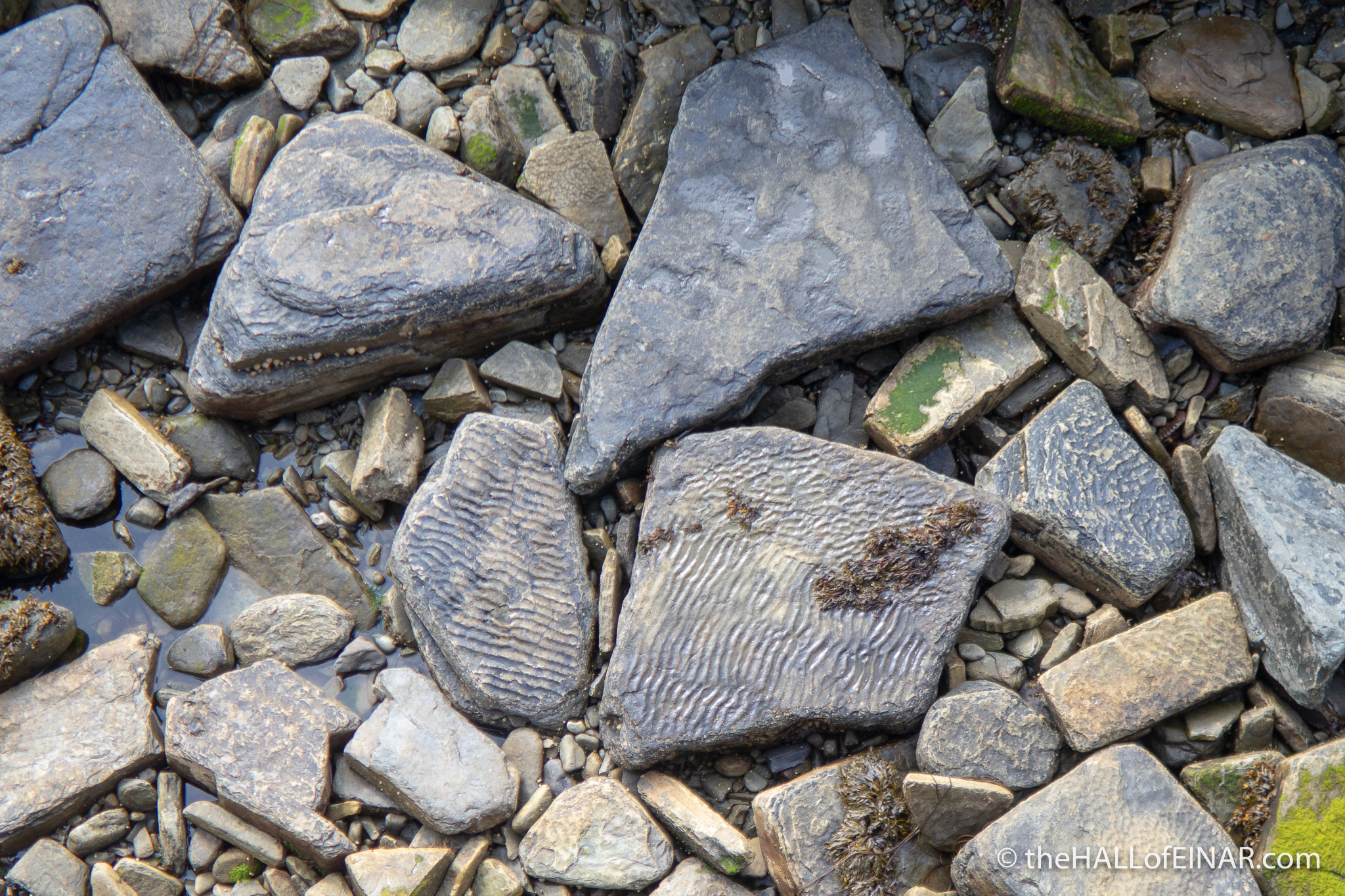
Instead I walk on. There’s a long way to go and I have to imagine that lake, those ripples, and what that length of time means to me. What is three score years and ten compared to geological time and the evolution, extinction and evolution again of the diversity of life on Earth which resulted in me? What a joy to be here for such a moment and to feel the enormity of time rolling through a dimension none of us can see or touch.
The three hills of central Westray are to my right as I walk: Fitty Hill; Gallo Hill; and Knucker Hill. I can see the steep slopes of Fitty Hill as I approach and then skirt around it. It’s etched by deep grooves from the retreating glaciers of the last ice age:
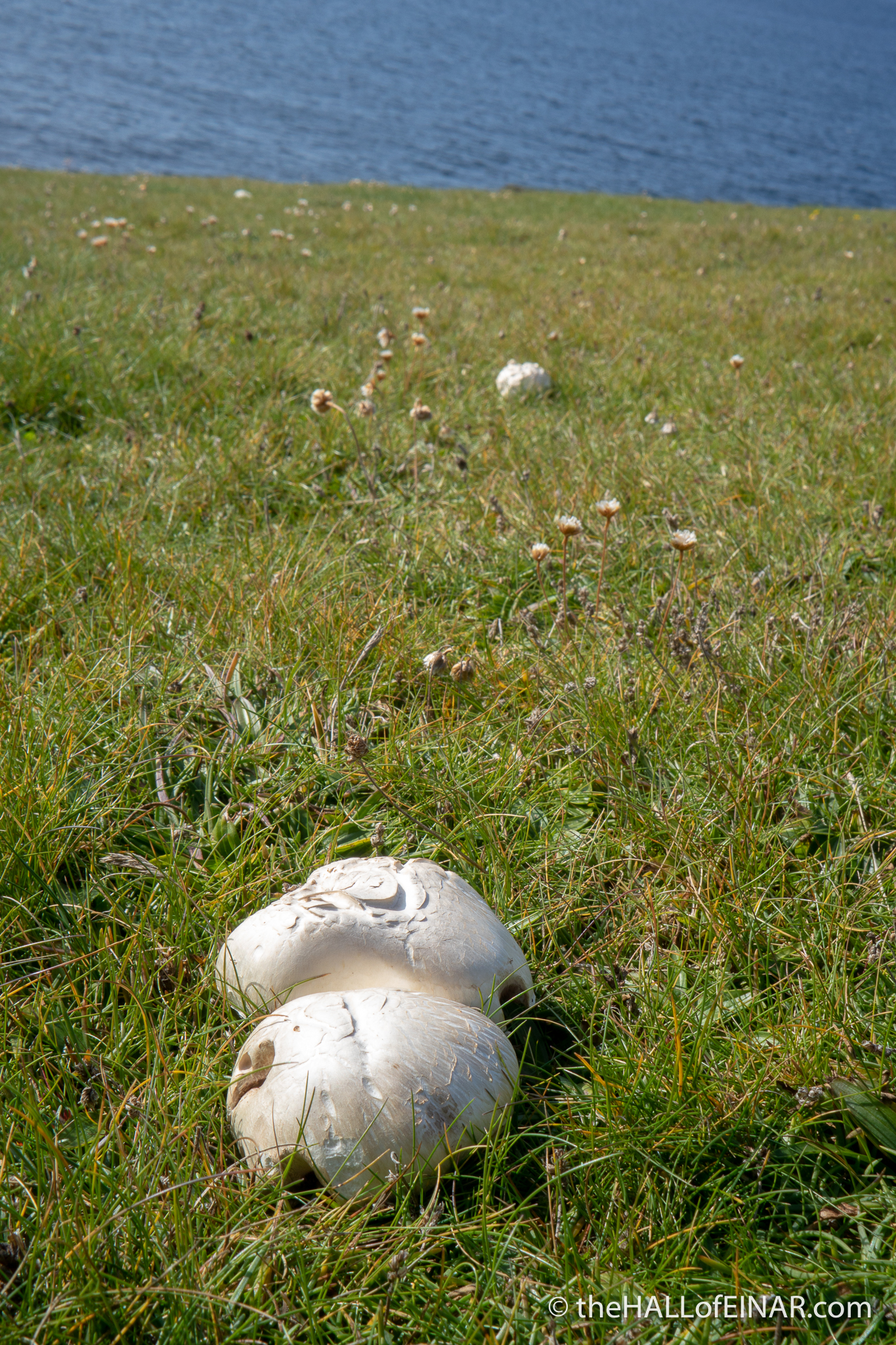
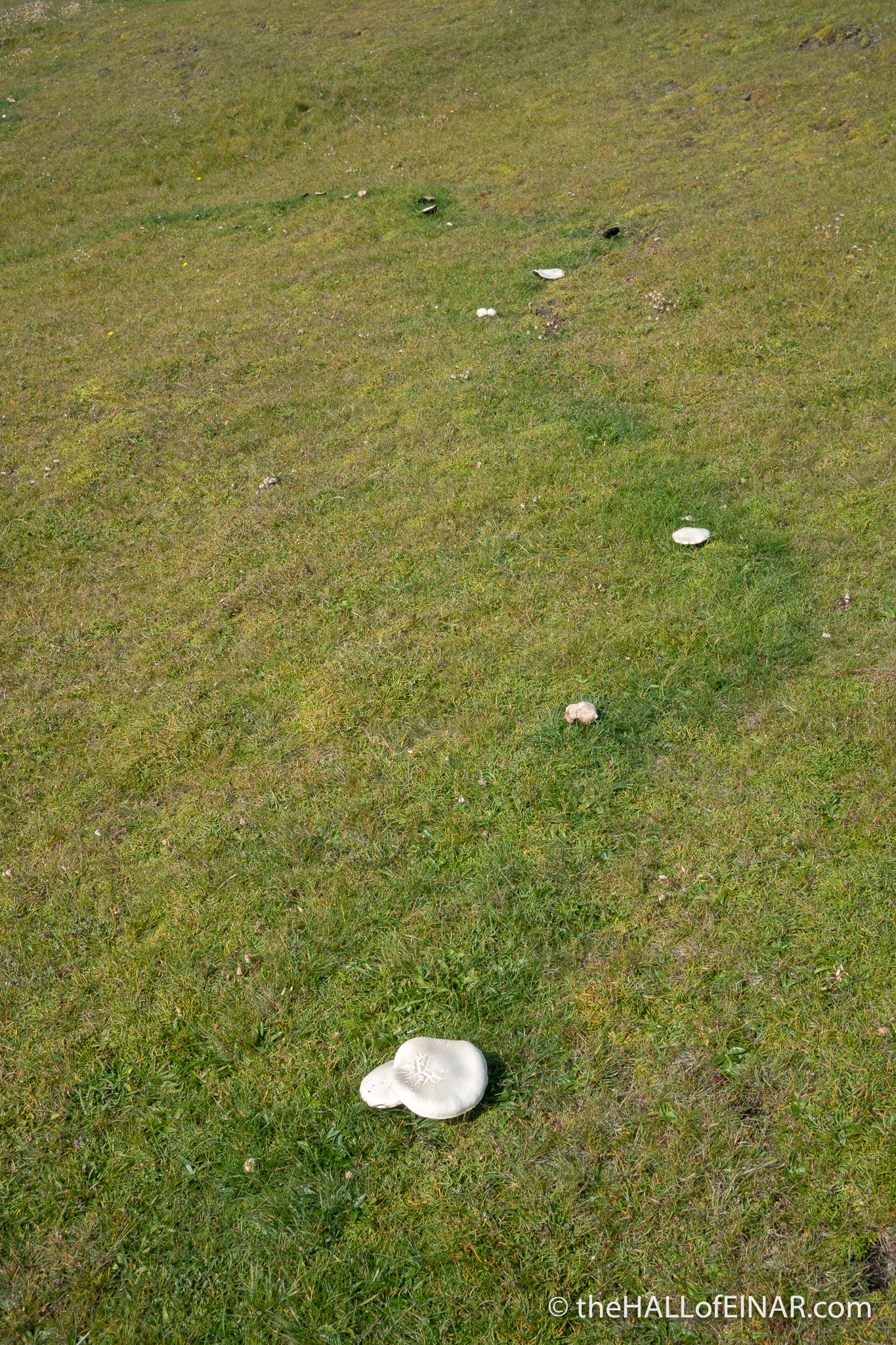
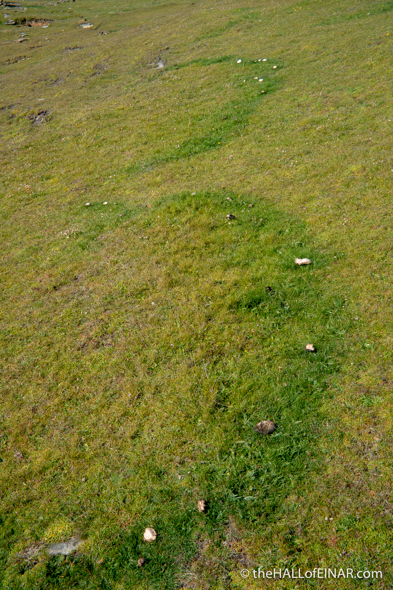
The fields in this part of the Island haven’t been poisoned with artificial fertiliser so there are mushrooms growing all along the coast in large fairy rings. They’re so good for the soil, they release nutrients, which make the grass grow a vibrant green, and produce magical fairy rings. These look more as if they were created by a drunken staggering imp though. These fairy rings are probably many hundreds of years old, as they grow slowly from the centre year by year, exhausting the nutrients as they grow. Some can be thousands of years old. It’s a shame these mushrooms are at the beginning of my walk; they are much better cooked fresh as they dry quickly. Hopefully I’ll find some others later.
I gain height above the glittering sea on a glorious day. I’m using a phone app to measure my progress. The problem is that it’s a fitness tracker and measures my position by GPS. Every time I climb vertically over a stile or a wall or clamber vertically up a bank it thinks that I’ve stopped and I hear a disembodied voice saying “Pausing workout” from my trousers, just as I’m putting in maximum effort. I’m glad no-one can see me; I’m giving heated feedback to a voice from my trousers.
It’s time for a picnic and to wince at how sore my septic toe is. It feels twice as big as it actually is. Cheese and pickle rolls and paracetamol work a treat.
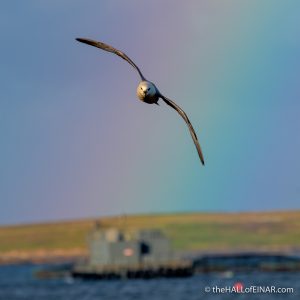
This must be the most magnificent section of the Westray Coast 50. There are freshly-fledged Fulmars overhead practicing their flying from their nursery cliffs:
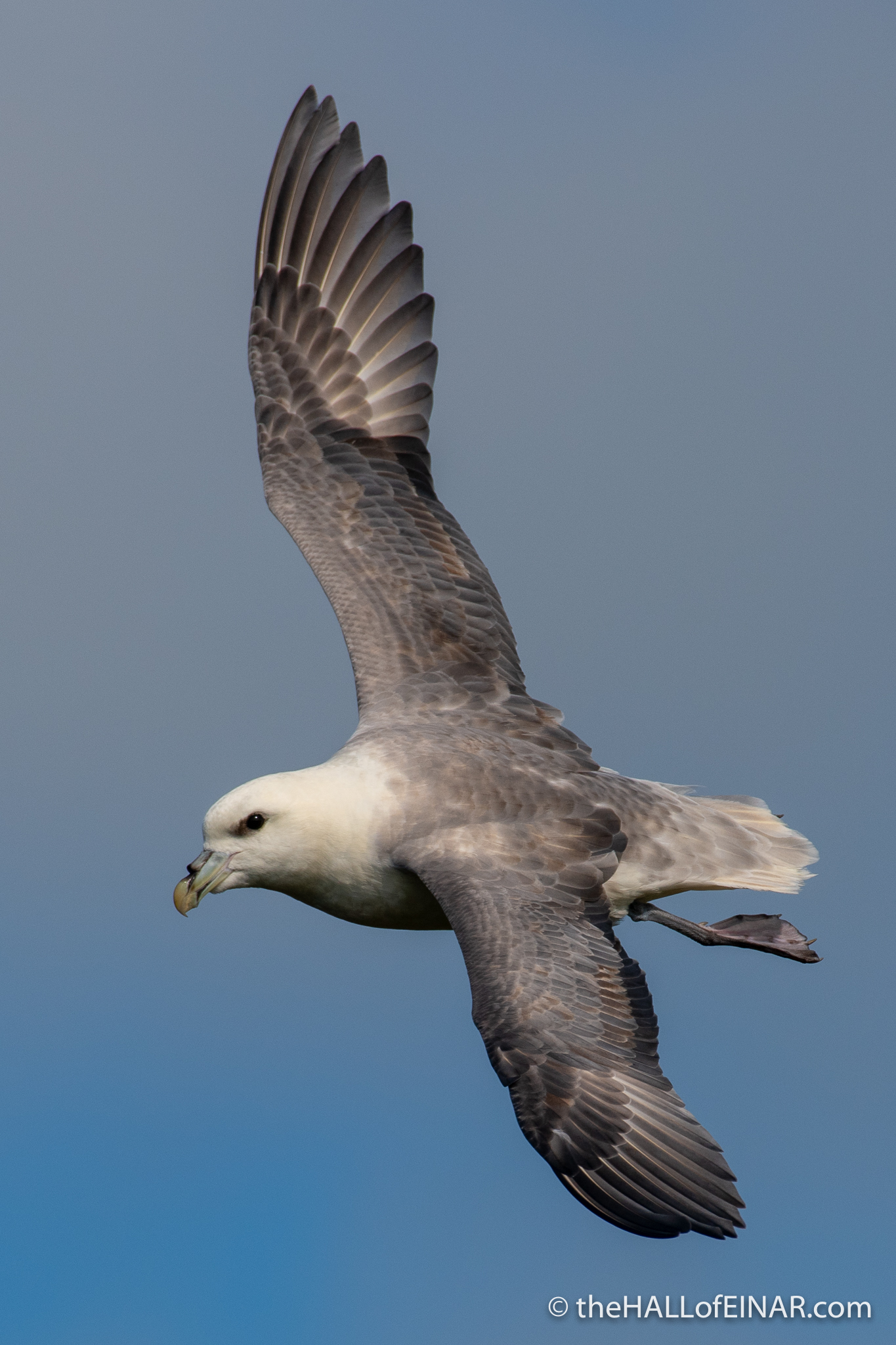
The light is beautiful and I can see every detail of their feathers as they fly like old hands, despite some of them being this year’s chicks. My camera’s incredibly heavy but the Fulmars are such a joy to capture, my camera feels lighter on my neck the more useful it becomes.
Meanwhile, pirate Great Skuas patrol the skies ominously above. They usually fly low and appear when I least expect them:
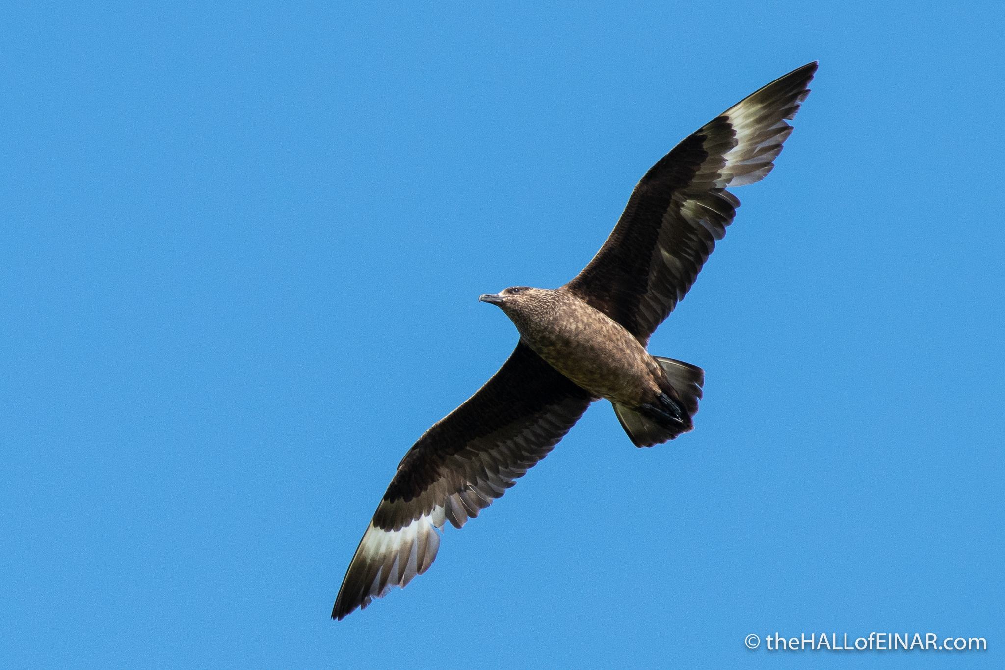
Is it just me who hums the theme tune from Jaws as Great Skuas appear?
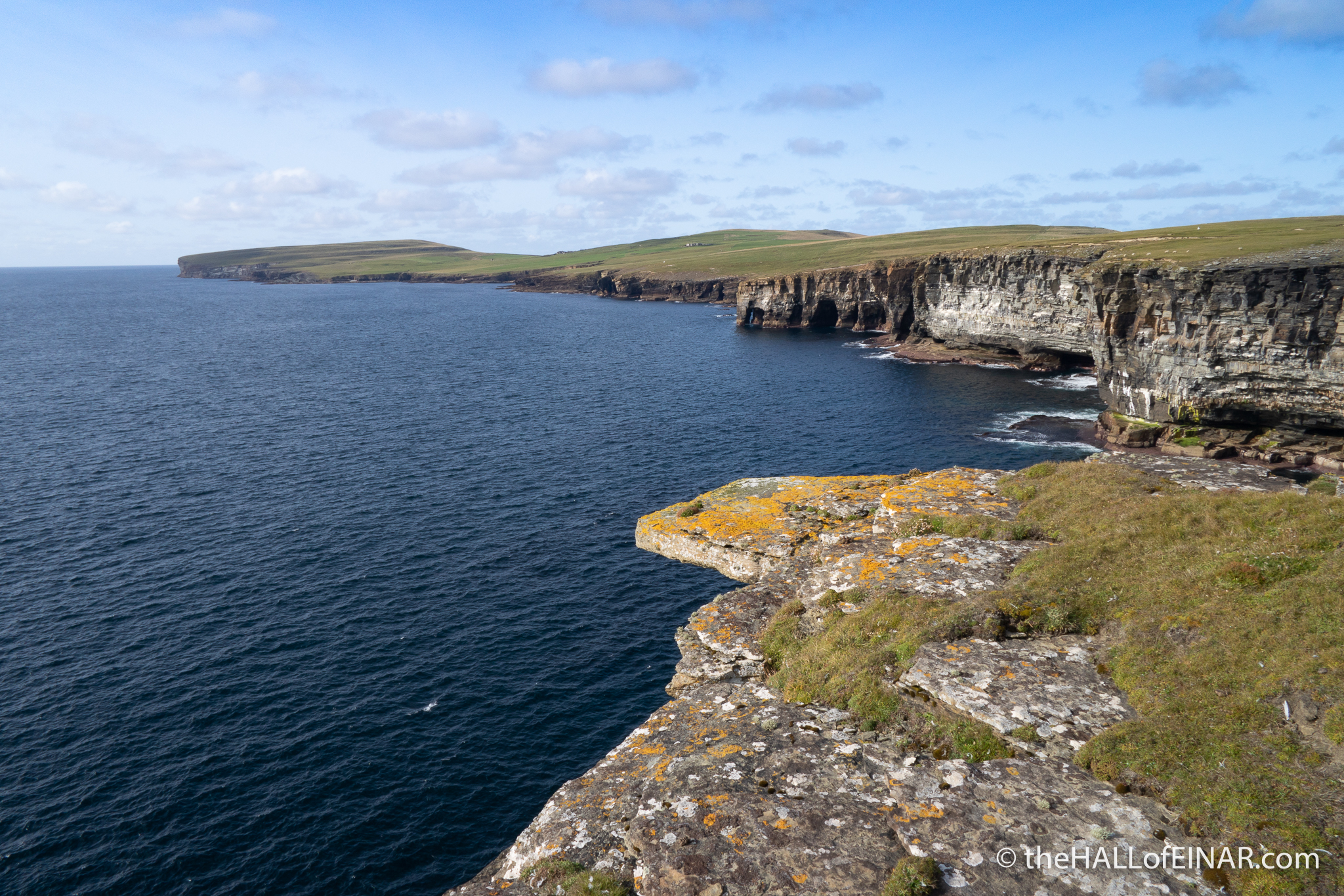
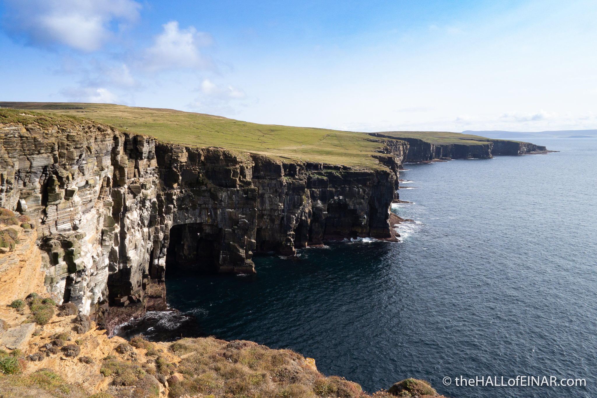
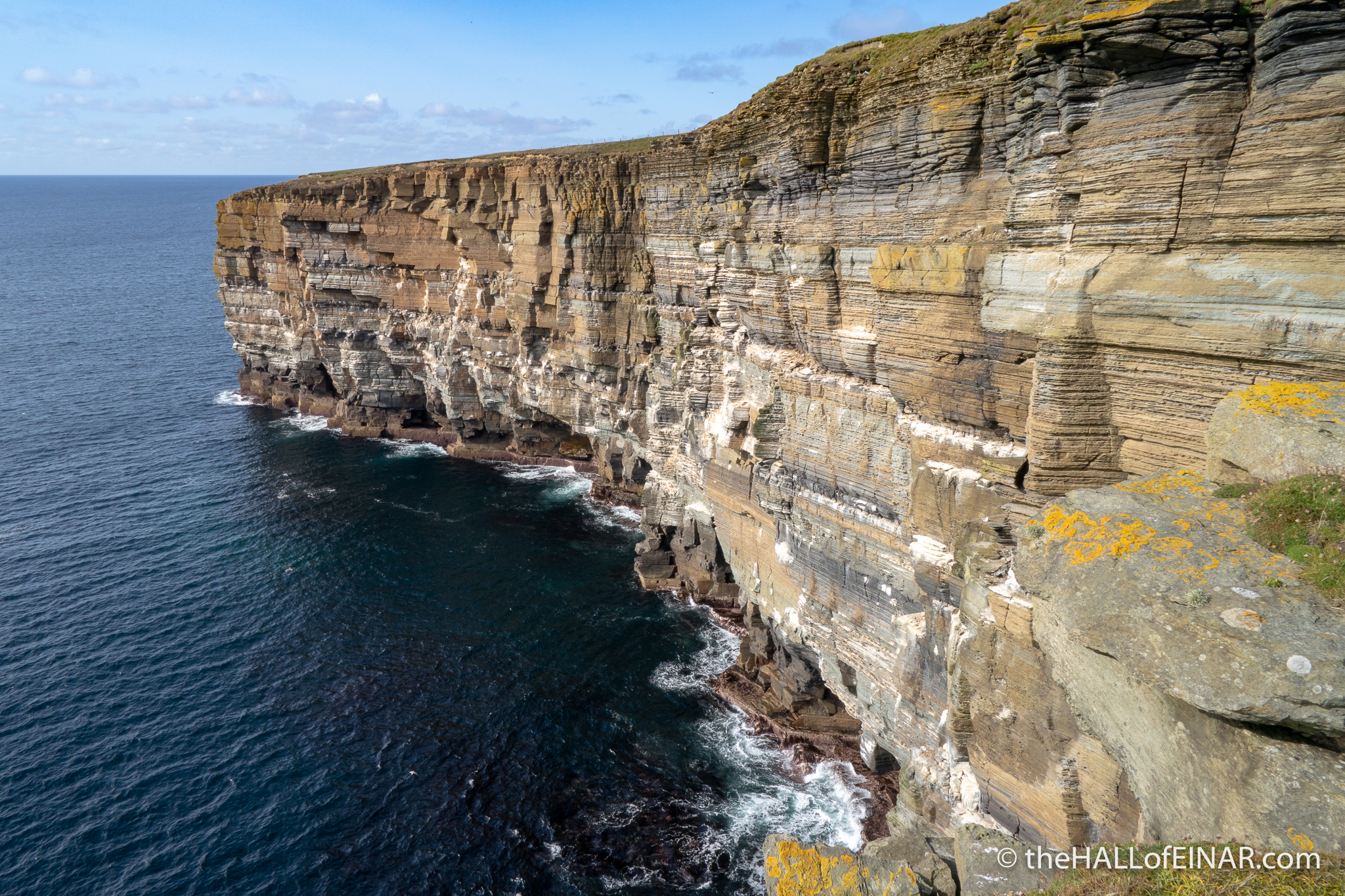
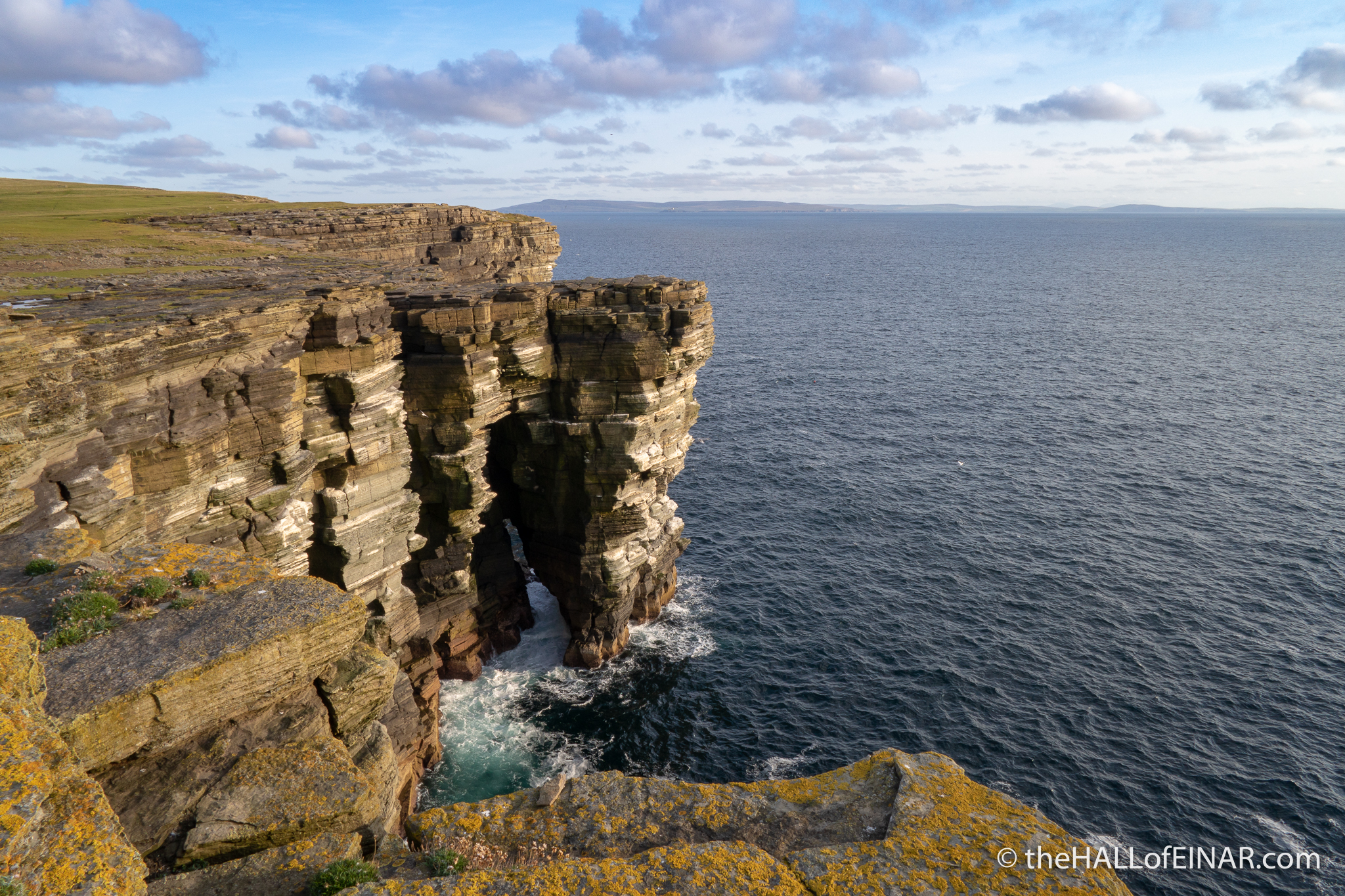
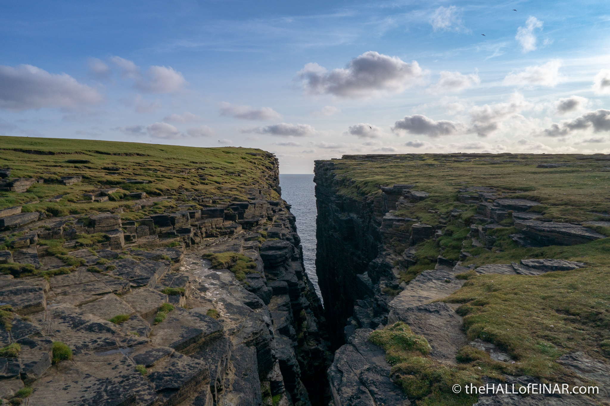
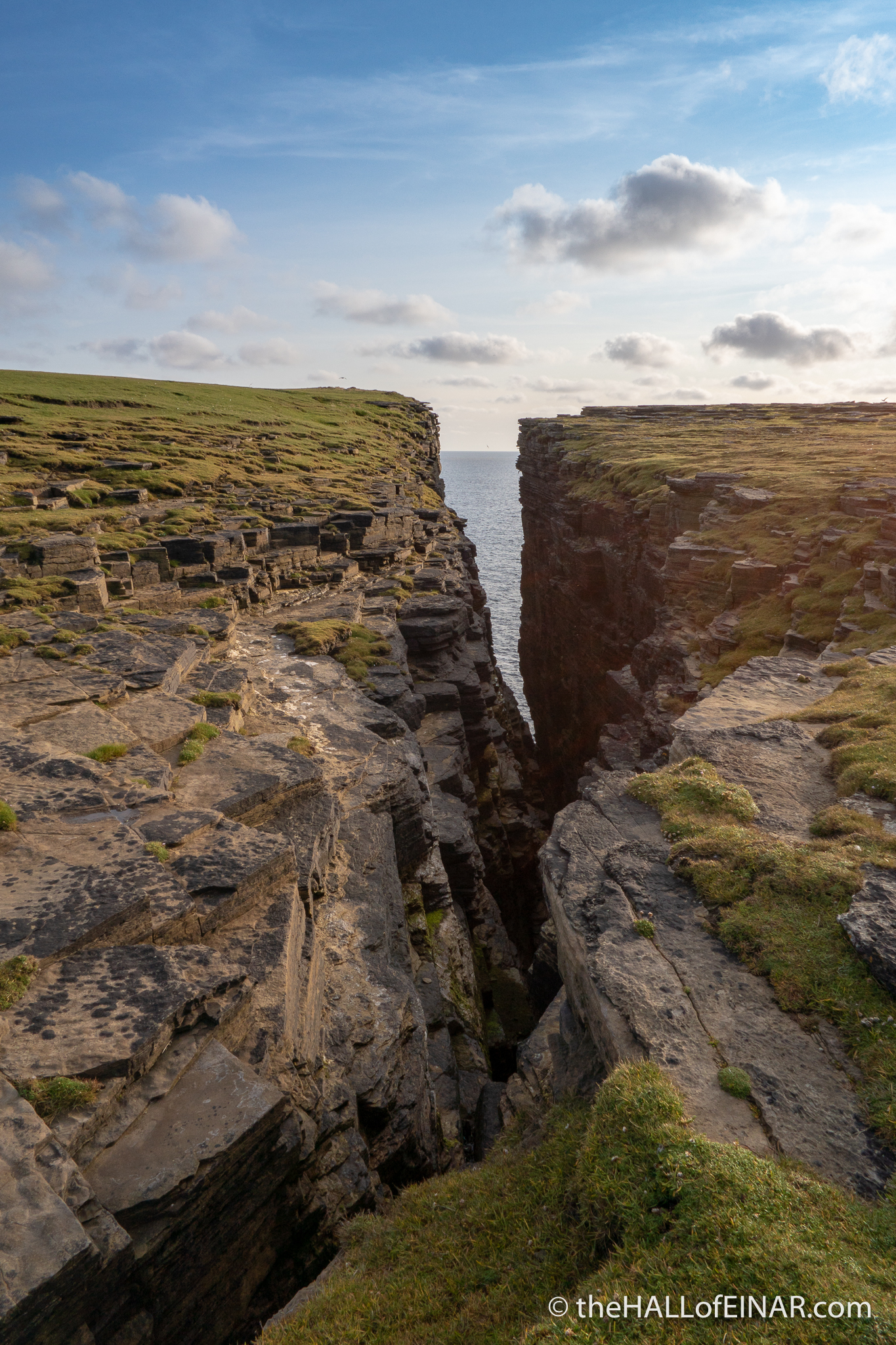
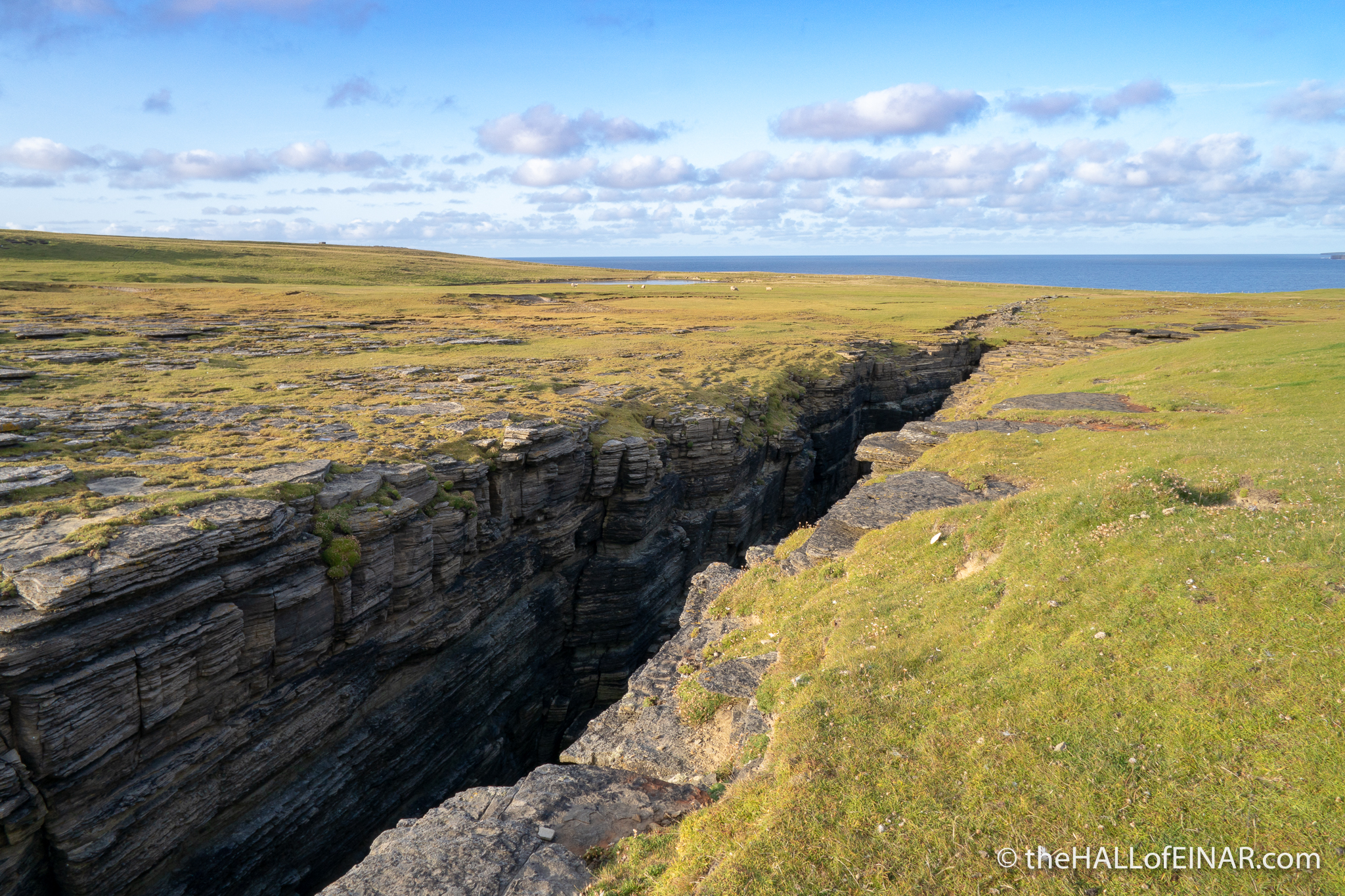
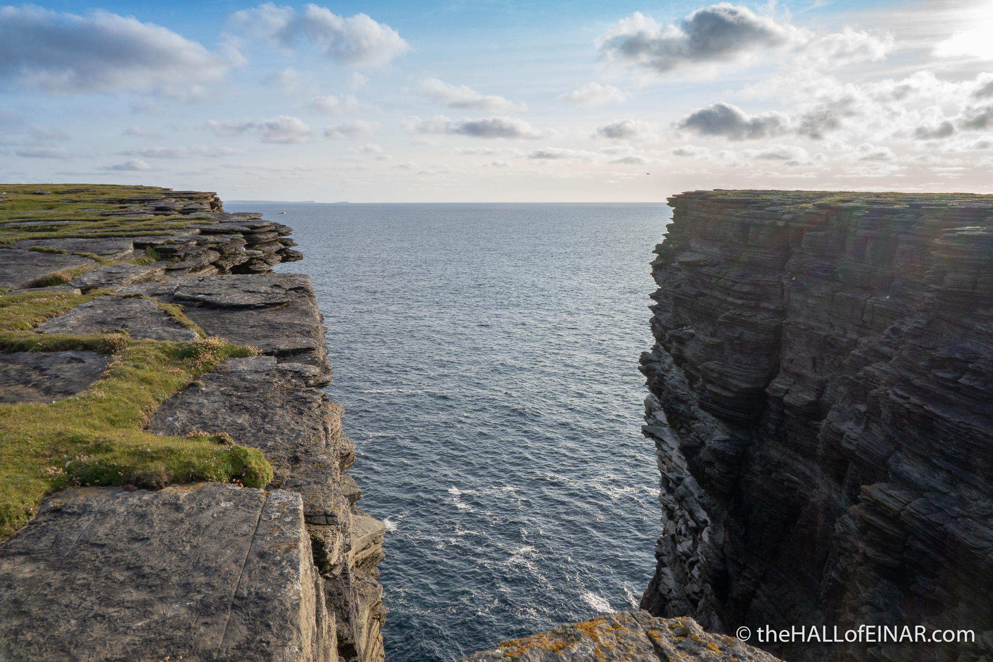
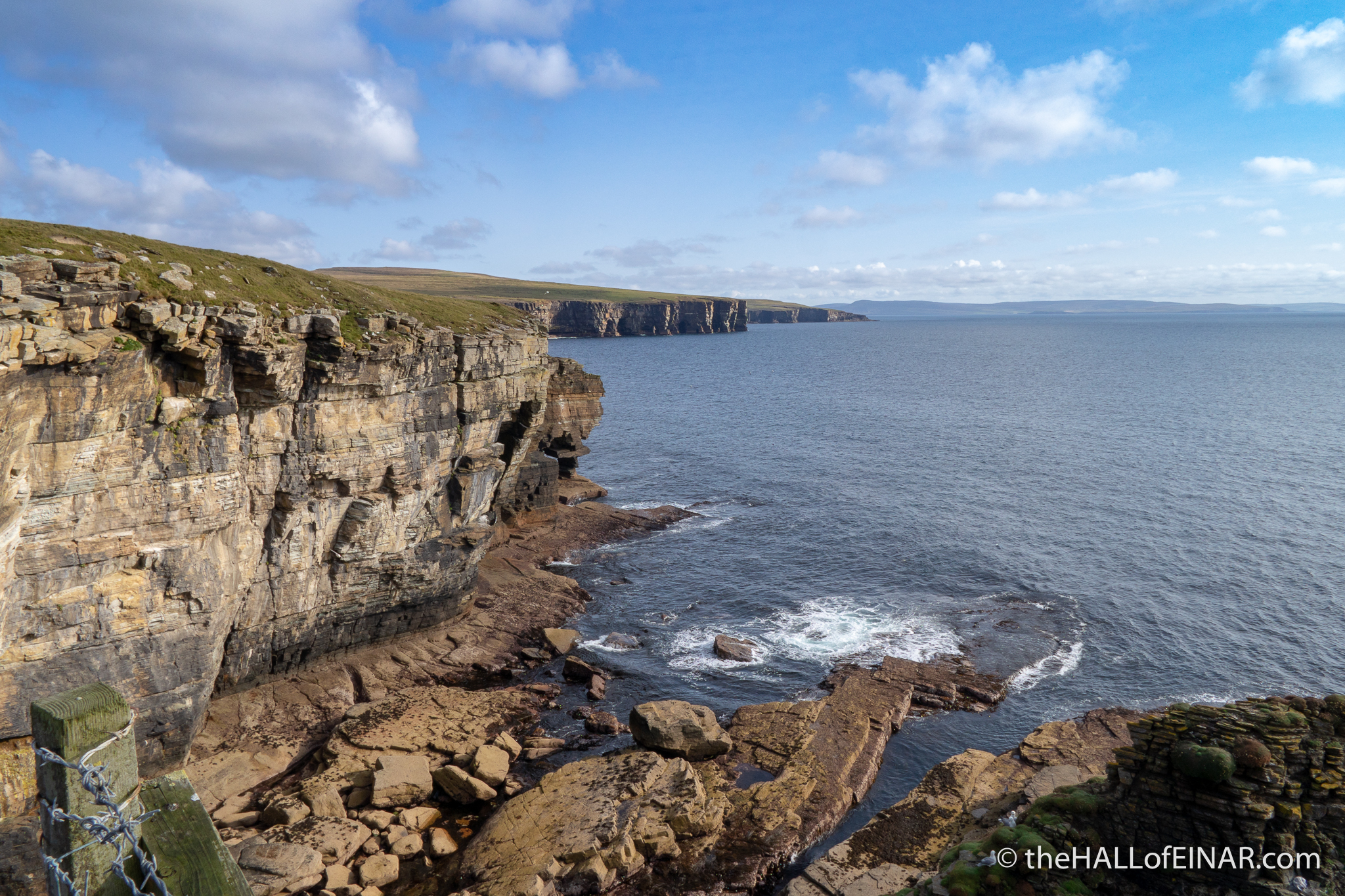
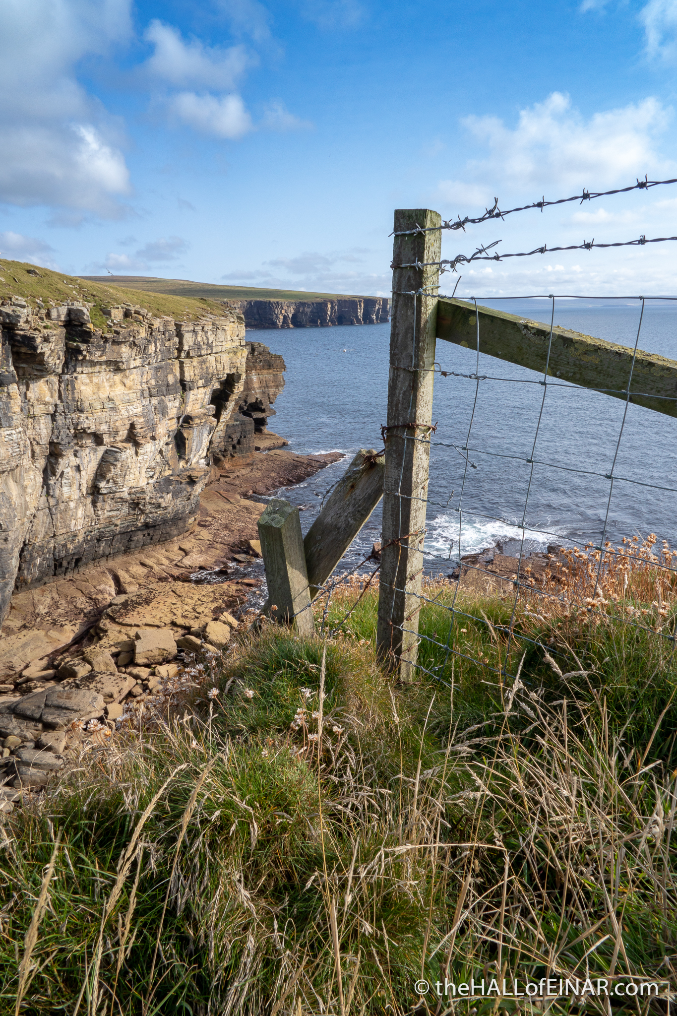
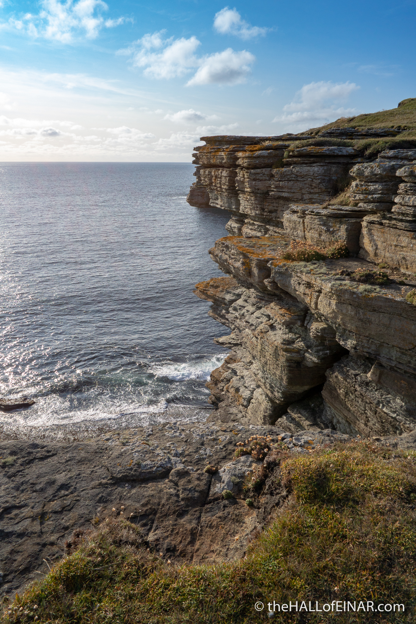
The Westray coast begins to become less gentle as I head north. There are cliffs, rocky outcrops called geos (with a hard ‘g’), and sea caves underneath my feet. In winter there are waterfalls. Now, they are dry. From Mirky Hole to Peerie Breast, from Red Nev to Ironi Geo and Andrew Seatter’s Breast, there are caves under the cliffs. It’s only when I look back from the next headland that I realise I’ve been suspended over the Atlantic on a thin ledge of rock.
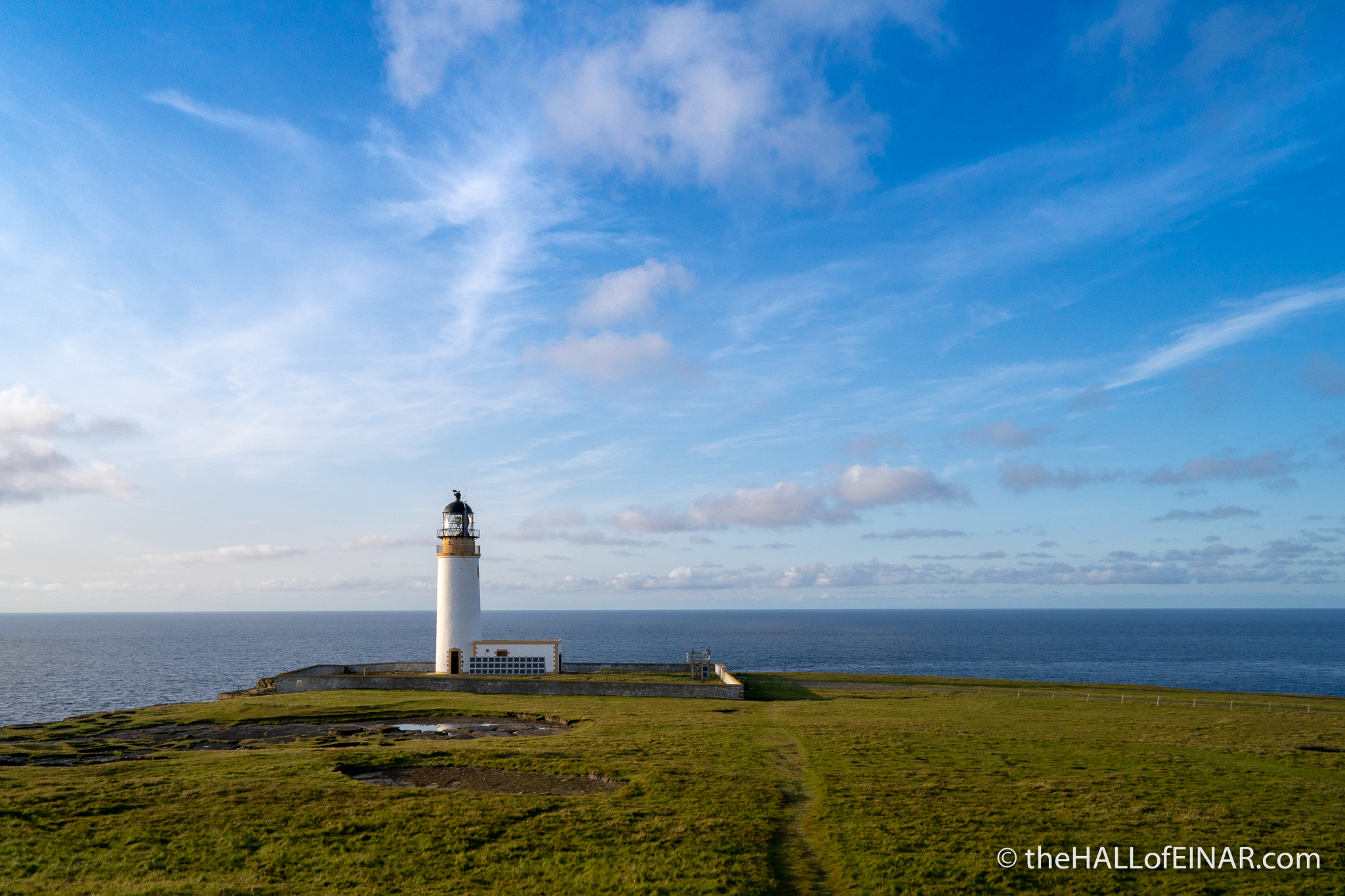
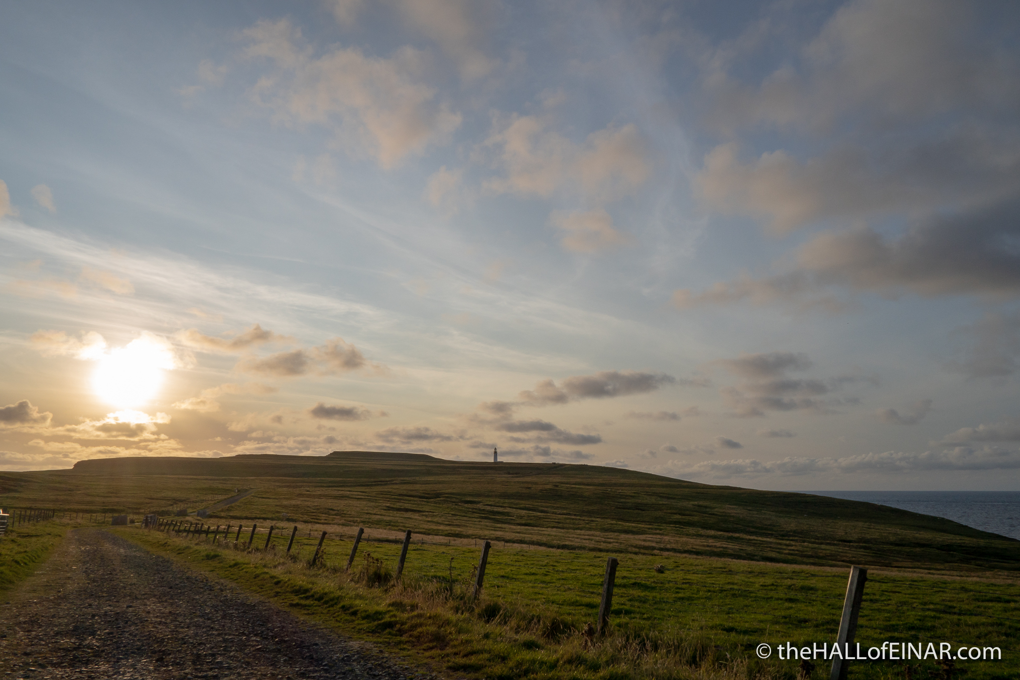
I started off at sea level. It’s been an up-and-down kind of day but I’m heading towards Noup Head Lighthouse and that’s at 74m.
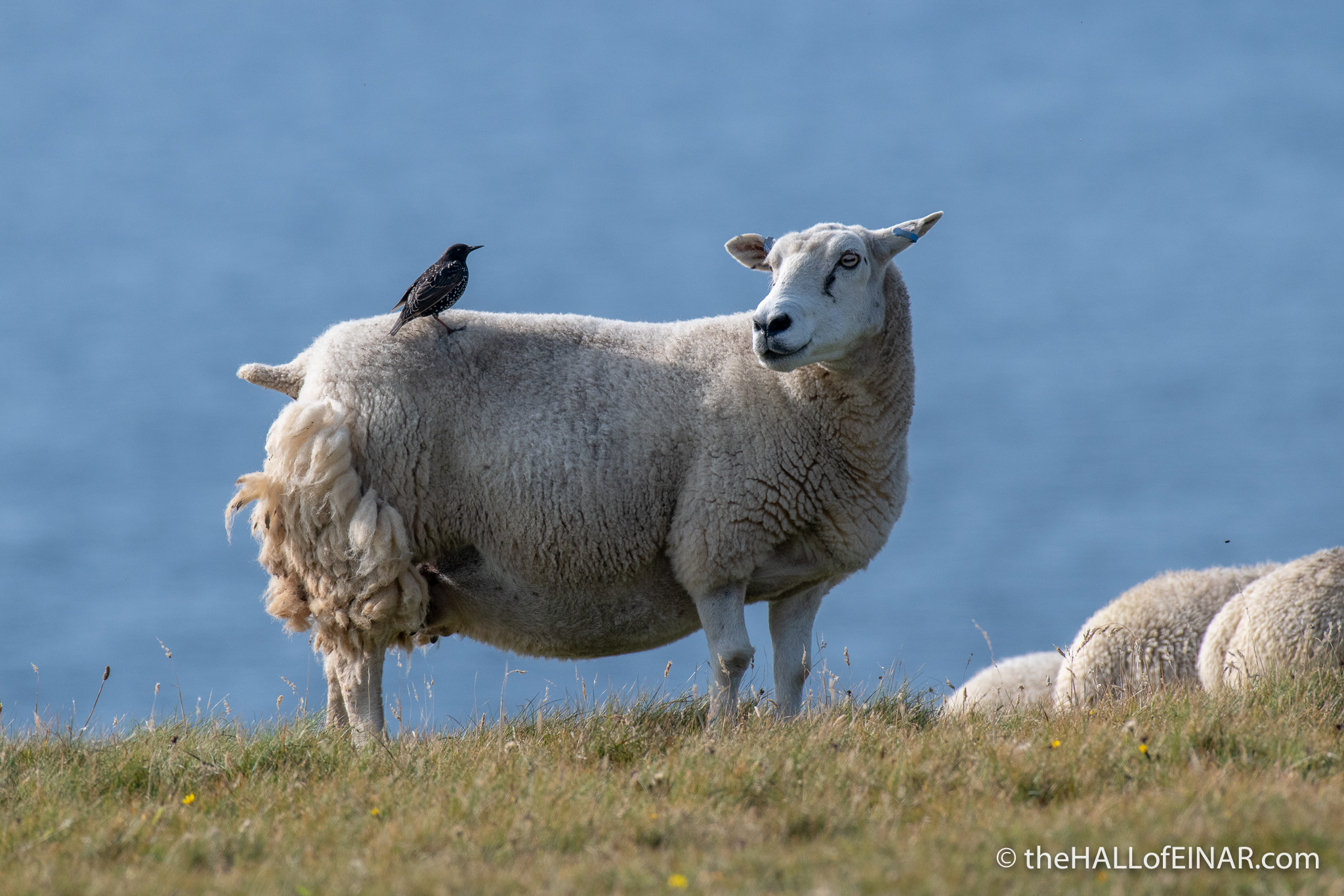
Just a note: Never take a dog with you on any walk on Westray. The whole Island is a farm and both sheep and cattle have evolved to react instinctively to approaching wolves. Sheep may trample off a cliff and cattle may trample all over you. Your dog, of course, will be fine. It’ll be the stock animals or you which will be horribly injured. Avoid the trampling. Leave the dog behind. Thank you.
This peculiar landscape of petrified freshwater lake mud, in layers hundreds of millions of years old, was uncovered 10,000 years ago, by ice retreating after the last ice age. On Westray the landscape’s curtains don’t match its drapes, as the soil is often red from the red rocks on Eday and doesn’t match the brown rocks on Westray at all. It was dragged here and deposited by the retreating glacier. Our soil is not our own, it’s Eday’s. I wonder whose soil Eday got?
There’s little glimpse on a day like today of the atomic-bomb power of the Atlantic which has carved it like a knife through a layer sponge. Its effects are everywhere:
In summer there are Puffins nesting on North Bis Geo and a scramble past the rock arches to Russa Tang reveals deep rock pools with red eel-like Butterfish amongst the red-jelly anemones. A wonderful thing about this walk is that I’m getting tantalising glimpses of my final destination as I wind in and out of the coast. Noup plays hide-and-seek with me in a baby game of peep-o. First it’s there and clear ahead, next it’s gone and mysterious again.
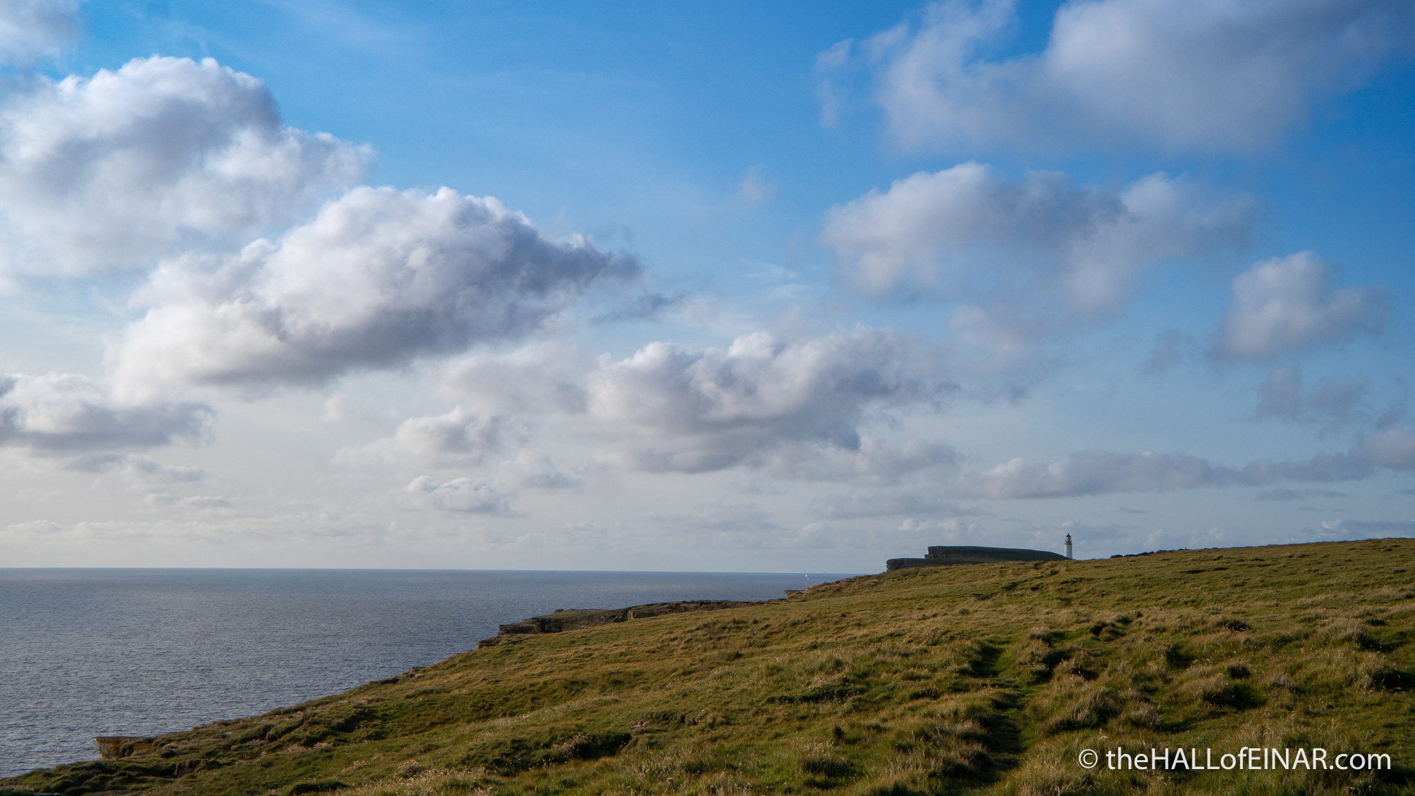
I skirt past North Hill and I’m at Noup. The busy cliffs are still full of nesting Gannets. The other birds, the Kittiwakes, the Guillemots and the Puffins have all gone for a winter on the Ocean’s waves. Gannets have the biggest chicks around and take the longest to fledge. It’s a seabird city here in the right month:
The rock fissures are very photogenic. Surely I’ve spent more time stopping to take photographs today than I have walking?
At Noup I make sure I walk between the sheep and the cliff edge so we don’t have a Far From the Madding Crowd incident here:
My walk isn’t over yet though. I’ve still to walk towards Noup Farm down the track to be reunited with my bicycle.
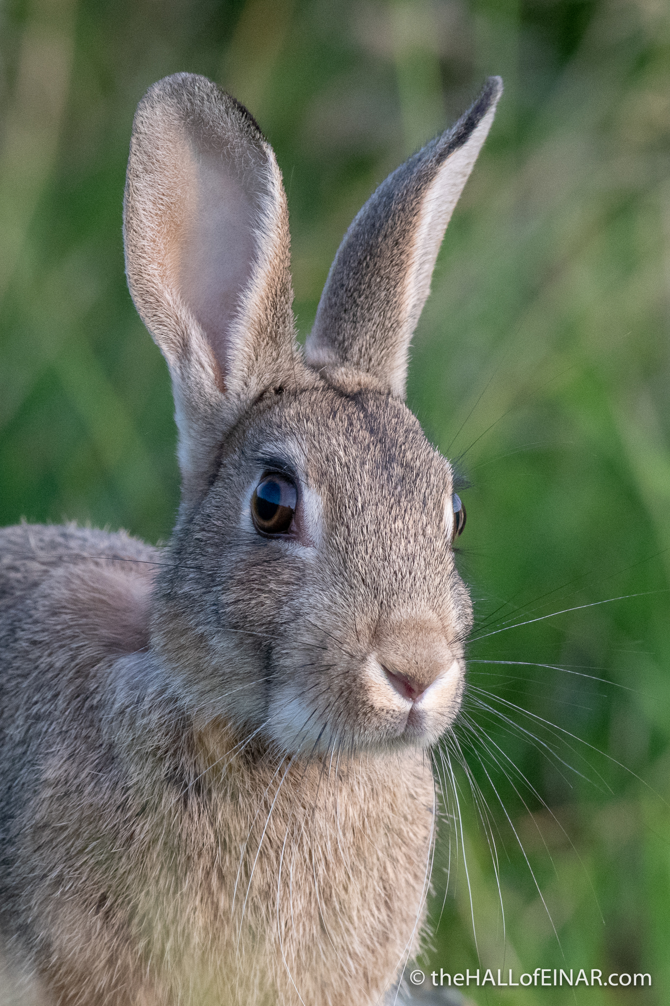
There are Rabbits in the fields with big eyes full of fear and reflected sunshine.
Finally I can see the ruin of North House and my unlocked bicycle, just where I left it. My walk for today is over. All I have to do now is cycle the 8 miles to Mae Sands and collect my car. I wobble down the steep lane full of large stones and potholes, scattering Starlings and House Sparrows as I go.
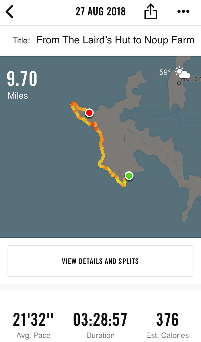
My app says it’s taken me 3 and a half hours to walk the 9.7 miles. It uses satellite GPS and is probably more accurate than the piece of string the postman used to measure the distance on the map 50 years ago. I’ve actually been out walking for 5 and a half hours and it’s past half-past seven in the evening now. That’s because I’ve spent two hours taking photographs along the way.
That was exhilarating. The weather was wonderful. The scenery was spectacular. The geology, archaeology and wildlife were fully on view. I felt completely, vitally, exceptionally alive. I’m also tired and my toe hurts. Back home I peel off my sock, which is crusty with blood. I’m thirsty and hot and cold at the same time. It’s definitely time for a bath, and a cup of tea. As I run the cold tap to swish the woodlice from the enamel I think about some of the sights and sounds of my first day of the Westray Coast 50:
Have you walked it?
I wonder; what will tomorrow bring? Please consider subscribing to my blog to find out.
And here, if you are wondering, here is why I did it:
This chapter was brought to you courtesy of cheese and pickle rolls I made with brown rolls from WFM Brown at the Westray Bakehouse, a washed-rind cheese, the Westray Wife, from Wilsons of Westray at Noltland Farm and Red Tomato Chutney from Westray Chutney. It was only possible due to a dark chocolate Tunnock’s Caramel Wafer. It was accompanied by incessant and mildly annoying humming of Richie and Ruben by Fountains of Wayne.
More on the Westray Coast 50
 2018 highlights of walking the Westray Coast 50 In 2017 I had a wild idea; I was going to walk the entire coast of the Orkney island of… read more
 Westray Coast 50 – Day Five My adventures on the fifth of five days walking the entire coast of Westray. read more
 Westray Coast 50 – Day Four and a Half My adventures on the four-and-a-half-th of five days walking the entire coast of Westray. read more
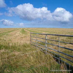 Westray Coast 50 – Day Four My adventures on the fourth of five days walking the entire coast of Westray. read more
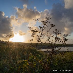 Westray Coast 50 – Day Three My adventures on the third of five days walking the entire coast of Westray. read more
 Westray Coast 50 – Day Two My adventures on the second of five days walking the entire coast of Westray. read more